“The next morning I washed and pinned up my rags as best I could and went out to replenish my wardrobe. I must indeed have been a tough-looking specimen the night before, because the first place I went into in the morning, a furnishing store, the dog growled at me savagely and disputed my entrance until called off by his owner.
It rained hard all day, and I remained in Cheyenne. while there I weighed myself and found that I was 12 pounds under my normal weight, the scales tipping at 141 pounds. I spent most of the day cleaning and fixing my wheel. Again, I aimed a hose on it, and after that I had to use a scraper and brushes before I could get down to work with a rag. I worked in the bicycle shop of G.D Pratt while there, and he extended me every courtesy.” The bicycle shop is no longer there, a modern Wells Fargo bank building has replaced it.
There was only a handful of hotels in town in 1903, one of the better ones was the Pioneer, and it’s just a few hundred feet away, there is a good chance George stayed there.
His short walk across the W. 17th St to Capitol Ave, this would have been George’s view
“It was raining a little when I left Cheyenne, and the roads were too heavy to ride. I took to the railroad again, and the railroad ties were not much better than the road. For 43 miles I had to pedal.
If you ever went for a ride on a tandem and took your best girl, or some other fellow’s best girl, and she was a heavyweight, and about 30 miles from home she gave out and you had to do all the pushing to get home, you have a slight idea how I felt pushing the motor over the railroad ties.
I got to Egbert at 12:45 and had dinner at the section house there.
It is downhill all the way now. I have turned my back upon the Rockies and their grandeur and am nearing the great prairie lands. I can see Elk Mountain, which, with its snow-capped peak is a landmark for hundreds of miles around and in spite of the troubles I have had in the rocky country, I feel somewhat regretful at leaving it.
I do not know what troubles the prairies hold for me, and I shall miss the inspiration of the mountain air, the gorgeous view, and the coyotes and the glimpses of antelope that I caught a couple of times back near Laramie.
One new sight I do have is that of prairie dogs, and as they sit beside their holes and yelp at me I take several pot shots at them. They dodge into their burrows so quickly that you cannot tell whether you hit them or not: even when shot through the head or heart these creatures dodge into their holes to die.
It began to rain when I had gone a mile and a half from the station house, and, remembering my last experience with the rain and the gumbo mud, I turned back and waited at the telegraph operating room until the middle of the afternoon, when the rain slackened.
I got to Pine Bluffs on the state line between Wyoming and Nebraska, at 4:40 p.m. To furnish an idea of how rapidly I have come down it may be mentioned that at Pine Bluffs the elevation is 5,038 feet, and this is only 90 miles from the summit, where the elevation is 8,590 feet, a drop of 3,500 feet in less than 100 miles.
During my first few miles of travel in the state of Nebraska I was nearly killed by a freight train. l was riding alongside the track, close to the outer rail, where the dirt over the ties is level, and a strong wind was blowing in my face, so that I did not hear the rumble of the train.
Suddenly I heard the loud shriek of the whistle right in my ears. I looked back and the train was not more than 10 yards away. I just had time to shoot down the embankment, which, luckily, was only about four feet high at that place when the train ran past me.
As it was, the engineer had whistled “down brakes” and was scared himself. It is fortunate that I was not riding between the tracks at the time, or I would have surely had to sacrifice my bicycle to escape with my life. If it had been a fast passenger train and got that close to me, it would have hit me before I got out of the way.
This was worse than the mountains, for nothing that happened there came so near to causing heart failure. I got to Kimball, 65 miles from Cheyenne at 6:50 p.m.
Kimball NE
They told me there that the roads are good when it is not raining. I had to take their word for it, and conclude that I still carry some sort of a hoodoo with me, in spite of having shed my fancy waistcoat, for when I get into a region of good roads it rains and spoils them, and when it doesn’t rain I am in a district where the roads are never good.”
June 7, 1903 (Kimball to Ogallala, NE)
“On Sunday morning, June 7, I left Kimball, Nebraska, and made the biggest day’s run that I scored west of the Mississippi. It is a fine, grain-growing country that I rode through from Kimball, which is a prosperous town. For the first 12 miles the country was rolling and the roads sandy.
After that I found good hard roads all the way to Sidney, 35 miles from Kimball, and I made it in just three hours, reaching Sidney at 10:15. I stopped for gas here and the adjacent building had this old Honda advertisement painted on its wall, made me wish I was on the Postie bike and its gargantuan 8 hp
When I rode into the place, which is a division town, I passed as tough a bunch of citizens as I met all through the West. They were young fellows loafing on a corner, and they tossed all manner of taunting comment at me, as if inviting trouble. I kept on my way without replying, which was wise, but not easy to do. After getting some gasolene(sic), I left at 10:30, and had no trouble making Chappell at 12:15, where I had dinner.
G.Wyman
I started again at 1:07 p.m., and quickly found that the good road was at an end. It became so bad, in fact, that I took to the railroad and rode the ties most of the way into Ogallala, 114 miles from Kimball.
Of this distance I made the first 65 miles in five hours, and had I had as good going in the afternoon as I had in the morning, I would have made 140 miles.
It began to rain shortly before I got to Ogallala, and I had to pedal over the last 15 miles. Of the 114 miles I made this day, 46 were ridden in the State of Colorado, for the railroad and road both put in a bend from Chappell southward to get to the South Platte River at Julesburg, Colorado and then the road follows the river valley back again into Nebraska; so that 46 miles was all of Colorado I saw.
This is the Railroad depot in Julesburg today
…back into Nebraska…
I found one good stretch of road five miles long in the 46 and this was a relief from the railroad ties so I blessed it and took a snapshot of it for a Colorado souvenir.
Ogallala is only a “little jerkwater station,” as they say in this country, but it was nightfall when I reached there, and it was raining hard, so I put up there for the night.”
June 8, 1903 (Ogallala to Maxwell, NE)
“It is now the time of the heavy rains, cloudbursts and freshets that devastated so much of the Western country during the month of June. It is my luck to be right in the particular great basin where the waters flow most copiously.
At Ogallala, Nebraska, I was told that there had been nothing but rain there for the last two weeks. The roads were in terrible condition, I know, when I left there at 6:45 o’clock, on the morning of June 8. After 10 miles of heavy going through the mud, I struck sand, and then took to the railroad track once more.
After going six miles over the ties it began to rain so hard that I had to get off and walk three miles to the station at Paxton.
The railroad depot was moved to the other side of the tracks, but still the same building, I think, it’s now an antique store!
There I waited for three hours until it stopped raining, and set out again at 12:30 o’clock. From there it is just 31 miles to North Platte, and as the sun had come out, I returned to the road. I found it good in places and sandy in spots. There was one stretch, two miles long, so sandy that I had to walk it. It was like being back again in the deserts. I got gasoline at North Platte and pushed on 16 miles to Maxwell, which made 70 miles for the day’s travel.
Maxwell is a little bit of a place, and I had to take accommodation in a room that had three beds in it.
Things are still as slow in Maxwell
I stayed here too, maybe I should have found a room, but instead, I got a lightning show and a night of rain in my tent.
A couple of surveyors were in one of the other beds, and at midnight, a commercial traveler was ushered in and given the third bed. I was fortunate in having a bed to myself at all the small places, for “doubling up” is quite the common thing where accommodations are limited.
One more cyclometer was sacrificed on the ride from Ogallala to Maxwell, snapped off when I had a fall on the road. I do not mention falls, as a rule, as it would make the story one long monotony of falling off and getting on again. Ruts, sand, sticks, stones and mud, all threw me dozens of times.
Somewhere in Emerson I remember a passage about the strenuous soul who is indomitable and “the more falls he gets moves faster on.” I would like to see me try that across the Rockies. I didn’t move faster after my falls. The stones out that way are hard.” The route so far, San Francisco to Maxwell Nebraska
June 2, 1903 (Walcott to Laramie, WY) “From Walcott, which I left at 6:30 a.m., it is uphill traveling eastward all the way to Laramie. I passed through the mining town of Hanna, peopled mostly by Finns and Negroes…
…and past the railroad stations of Edson, Dana, Allen and Medicine Bow.
At the place last named I ripped out some more spokes, and after fixing up the damage temporarily, I took to the railroad and followed it, in preference to the road, into Laramie. I was at the end of my day 3 of riding, George at this point, as a comparison, had been on the road 18 days. Wyoming is known to be a windy place even though he doesn’t mention it. Modern-day Wyoming windmills are everywhere.
I decided to start looking for a place to camp for the night, hopefully out of the wind, just outside Medicine Bow there was a dispersed camping spot 3 miles off the route. The turn onto the dirt road was by the little Museum (red roof, closed) where there is a marker for George’s ride.
The building across the street is the Virginian Hotel, construction started in 1901 and wasn’t finished until 1911 and at the time was the most expensive hotel west of the Mississippi River. It was a good place to sleep, grab a bite to eat, etc. and is still open for business today.
Medicine Bow had a population of around 100 +/- in 1903, and only 253 today, so you would think everyone would know everyone and everything that ever happened there.
I went down the dirt road, and found the place to camp, by a lake and I’m the only one there, right up until a truck pulled up with an elderly couple and three dogs. We get to talking and she had lived in Medicine Bow her whole life, he family arrived here in the 1880s and started the little town.
“do you have any stories about George Wyman, that maybe the history books don’t know about?” – “Who?” “George Wyman was the first person to ride a motorcycle across America and he stopped here in 1903, there’s a plaque in the museum about him.” – ” I am so embarrassed, my best friend runs the museum, I probably go in there a few times a week to see her and never knew anything about George. Even my parents and grandparents never mentioned it, that I can recall when I was a kid…so sorry I can’t help, but now I need to go and research.”
They left and I set up camp and made some food and enjoyed the sunset until the mosquitoes arrived
I checked my spokes, I mean why wouldn’t you, coincidental failures and all that…they were good. The wind picked up a little and mosquitoes disappeared and I sat enjoying the clear skies and the Milky Way
This was the first place that I really felt enthusiastic from the time I left the coast. Laramie is a big, fine place of nearly 10,000 (pop 32,363 in 2023) and is in the greenest country I had seen since I left Sacramento. That is how it struck me, and I felt glad to be there.
It seemed as if it was a place where someone lived and where folks could live. It is a fertile country all around there, given over largely to sheep and cattle ranching, and has a natural, civilized look that I did not find anywhere in Nevada, and only in little touches in Utah between big stretches of wilderness. I saw some of the finest baldface, big-horn cattle there that the country produces.
This is where Bill Nye appeared on the horizon of humor, I believe, when he was “sticking” tape for the Laramie Boomerang. I recalled this and could understand that a man might be a humorist living in such a place.
I could not revel in the delights of Laramie as I would have liked, for I had troubles of my own to attend to. It was 7:05 p.m. when I got there, and I hunted up the bicycle shop of Elmer Lovejoy. He furnished me with five new spokes and placed his shop at my disposal, for I preferred from the first to do all the repairing to the motorcycle myself.”
Lovejoy Motorcycle Garage, c.1905
The Lovejoy shop or even the building is no longer there, it is now a parking lot, but on the adjacent building…
June 4,1903 (Laramie to Cheyenne, WY)
“Up in the air was the program from Laramie – almost straight up it seemed to me at times, so steep was the road. They told me in the town that by leaving the railroad and taking the road over the ridge I would save 20 miles.
Maybe I did. I went over the “ridge” anyway. I climbed steadily for 8 miles, and when I reached the summit I was at the highest point I touched in my entire trip, and higher up than I ever was in my life before. The altitude at the top is 8,590 feet.
Today this crossing is slightly different looking and part of the I-80/ Lincoln Highway and still the highest point on the route even though where I crossed is at a slightly difference place than where George crossed
Going up I followed a narrow trail full of stones and sharp twists around boulders and the best guide I had to keep from going wrong was the hoof-prints of the presidential party that had gone over the summit the day before. It would have been easy to have lost the trail had it not been for the hoof-prints, but I followed them and knew that I was right, for the President’s party had a guide.
At the summit is a flagstaff, put there by a survey party I believe, and someone in the Presidential party had hoisted a handkerchief on it the day before, so I took a snapshot of it. Then, before I left I rested myself by putting this inscription on the pole: “G.A. Wyman, June 4, 1903, 11:30a.m. – First motorcyclist to cross the Rockies, going from San Francisco to New York.”
While I was on this summit, it clouded up and began to thunder ominously. I had no more than started on the descent than it began to rain in torrents. The water just dropped from the clouds as if they were great lakes with the bottoms dropping out.
In one minute I looked as if I had been fished out of a river. There was no place to seek shelter. either(sic), not even a small tree, for the mountaintop is “bald,” so I had to keep going. After running down about three miles my belt would not take hold and I had to get off and walk.
So long as I was on the ridge where the ground was all rocks it was not so bad, but when I began to get down to the lower-lying land my trouble settled upon me in earnest. Down at the bottom I struck gumbo mud, and it stuck me. Gumbo is the mud they use in plastering the crevices of log louses.
It has the consistency of stale mucilage and when dry is as hard as flint. It sticks better than most friends and puts mucilage to shame. When you step in it on a grassy spot and lift your foot the grass comes up by the roots. My wheel stood alone in the gumbo whenever I wanted to rest, and that was pretty often.
Every time I shoved the bicycle ahead a length I had to clean the mud off the wheels before they would turn over again. I kept this up until finally I reached a place where I could not move the bicycle another foot. It sunk into the gluey muck so that I could not shove it either forward or backward.
I found that it had taken me two hours to travel half a mile, and I could not see New York looming in front of me with any particular prominence. In fact, I could not see a sign of any settlement or human habitation anywhere, and I was in a quandary what to do.
I had set out to travel to the Atlantic coast with my motor bicycle, and thus far I had done so, though I had done some walking, I did not like to part with the machine right there, for in the long run, the walking would be worse than the riding. I finally left the bicycle sticking bolt upright in its bed of gumbo mud and set out to find a place where someone lived. This move led me to a pleasant experience, the hospitality of the Wyoming ranchers.
After walking two miles I came to a ranch house, and I was lucky to find it for there is not another house within seven miles. The ranch (of sorts) is still there in the same location, and none of the original structures are left
The young man I met there immediately hooked up a team of horses and went back with me and pulled the wheel out of the mudhole.
When I got to the house my rescuer, who was R.C. Schrader, of Islaly(sic) Station, Wyoming lent me a hose, and with the aid of a stream of water and a stick, I got the machine fairly clean after an hour of hard work.
Mr. Schrader was a hearty host. I had eaten nothing since an early breakfast, and it was then 5 p.m. He made me stop and eat, and then, as I insisted on pushing along, he showed me the way to the railroad track. I was glad to see the ties again. It was about 20 miles to Cheyenne, and I walked most of the way, arriving there at 10:30 p.m.
About an hour after I left the Schrader farm it began to rain and kept it up till I was within two miles of Cheyenne. When I reached there I was a sight for men and dogs. I was mud and tatter from head to feet. A colony of tramps would have been justified in repudiating me, for my face had been washed in streaks and the mud remaining on it was arranged as fantastically as the war paint of an Indian buck.
My shirt is splashed with mud, too, and I miss my vest because I could remove it and make a better front in the town, I have missed that waistcoat all the afternoon, for there was snow mingled with the rain and I was cold: but I took off he vest, a light, fancy affair, some time before reaching Laramie and threw it away because I took a notion it was a hoodoo.
With my coat torn in several places and one sleeve of it hanging by a thread, my leggings hanging in shreds, no waistcoat on, dripping wet and splashed with mud all over, I checked my bicycle at the baggage room of the railroad station and set out to find a room in Cheyenne.
Cheyenne train depot c.1903
“All full” was the word I got at the first hotel, and at the next it was the same. After I had tried three and been refused, I was satisfied that it was my appearance that was the reason. To make the matter worse, I discovered that my big “.38” revolver had worn a hole in my pocket and was sticking through so that it showed plainly between the torn part of my coat.
I must have looked like a “bad man” from the wilds that night, and, realizing this, I made it a point to tell my story In explanation, after I had been refused accommodations at the hotels. After visiting a couple of boarding houses and being turned away I finally found a woman who kept furnished rooms, who eyed me suspiciously and said she had no room, but would fix me up a cot. She listened to my story and finally fixed me up a nice room, and I stayed there two nights. “
George’s route so far San Francisco to Cheyenne WY.
“Leaving Granger, which is a division town of about 200 people and has one hotel, at 6:30 o’clock in the morning… The town today has less than half the population vs when George rode through, today it sits at about 94 people, and the only original building in both eras that I could find is the schoolhouse
even though it looks nothing like it did in 1903 I’m told the building was remodeled numerous times not knocked down and reconstructed
I found the road to Marston terribly rocky, and I returned to my old love, the crossties, after going half the distance, or about six miles. At Marston I found the old stage road to Green River, and many portions of this are gravelly and fine. Green River is quite a place with a population of about 1,500, * (11,262 in 2023) but I did not stop there. I pushed on past the famous castellated rocks to Rock Springs, 45 miles from Granger, and, arriving there at 11:45, I stopped for dinner. *When George says Dinner, this is actually lunch, and supper is his evening meal, just for clarification of timing during the day.
Downtown Green River, WY
You always eat dinner in the middle of the day in this part of our glorious country, and if you get up with the sun and bump on a motorcycle over the hallways of the Rocky Mountains, you are ready for dinner at 12 o’clock sharp, and before. At Rock Springs the country begins to look upward again, the elevation there being 6,260 feet, 200 feet more than at Green River. From Rock Springs on, except for one drop of 500 feet from Creston to Rawlins and Fort Steele, there is a steady rise to the summit, about half way between Laramie and Cheyenne. There the elevation is a cool 8,590 feet.
Rock Springs, where I had dinner, is in the district of the Union Pacific Company’s coal mines. It is memorable for labor troubles and murders of Chinamen. I had the ends of my driving belt sewed at Rock Springs, and set out again past Point of Rocks, 25 miles east to Bitter Creek.
Rock Springs Railroad station today
East of Point of Rocks the road Is fairly level, but it is of alkali sand, and when I went over it, it was so badly cut up that in some places I had to walk. Point of Rocks was a stagecoach stop, the building is still there up a dirt road, about 1/2 mile off the main road, easy to miss if you didn’t have a waypoint!
Bitter Creek might well be called Bitter Disappointment. I do not mean the stream of water that the road follows, but the station of the same name. It is one of those places which well-illustrates what I have said about the folly of taking the map as a guide in this country. About one-third of the “places” on the map are mere groups of section houses, while a third of the remainder are just sidetracking places, with the switch that the train hands shift themselves, and a signboard.
Bitter Creek belongs to the former class. The “hotel” there is an old boxcar. Yet, if you take a standard atlas you will find the name of Bitter Creek printed in big letters among a lot of other “places” in smaller type. The big type, which leads you to think it must be quite a place, means only that the railroad stops there. The “places” in smaller type are mere sidetracking points.
The boxcar is fitted-up as a restaurant and reminds one faintly of the all-night hasheries on wheels that are found in the streets of big cities. The boxcar restaurant at Bitter Creek, however, has none of the gaudiness of the coffee wagons. Still, I got a very good meal there.
When I cast about for a place to sleep it was different, but I finally found a bed in a section house. This experience was one of the inevitable ones of transcontinental touring. It was 7:15 o’clock when I reached Bitter Creek Station and it is 69 miles from there to Rawlins, the first place where I could have obtained good accommodations.”
June 1,1903 (Bitter Creek to Walcott, WY)
“After having breakfast in the boxcar restaurant, I left Bitter Creek for Rawlins. In this stretch, about 20 miles from Bitter Creek, I crossed my third desert, the Red Desert of Wyoming. It takes its name from the soil of calcareous clay that is fiery red, and the only products of which are rocks and sagebrush, and they will grow anywhere.
There is a Red Desert Station on the map, but there is nothing there but a telegraph office, and the same is true of Wamsutter and Creston, the succeeding names on the map. I took a snapshot of the road in the desert near Bitter Creek and wrote on the film: “Who wouldn’t leave home for this?”
East of Red Desert the road improved considerably, and from Wamsutter to Creston it was really fine.
It was along this fine stretch, just before reaching Creston, that I came to the Great Divide and took a picture of the signpost, which marks the ridgeline of the great American watershed.
Standing there and facing the north, all the streams on your left flow to the west and all those on the right side flow toward the east, the waters of the former eventually finding their way to the Pacific, and the latter to the Mississippi River. This is the backbone of the continent and it is duly impressive to stand there and gaze at the official sign.
It does not mark the exact middle of the continent though, as some have mistakenly thought. It is about 1,100 miles east of San Francisco. I had rather expected to find the continental divide, if I did come across it, on the summit of a mountain, in a very rough piece of country, but it is in a broad pass of the Rockies, that seems more like a plain than a mountain, although a commanding view is obtainable from there.
To the north are the Green, Febris and Seminole chains of mountains, and further, in the northwest is the Wind River range, and beyond that again the Shoshone range, while to the south are the Sierra Madres, all escalloping the horizon with their rugged peaks, here green, there shrouded in a purplish veil, and far away showing only a hazy gray of outline. One realizes that he is in the Rockies positively enough.
From Creston to Rawlins there is nearly 30 miles of downgrade, and, as it is a fairly good highway of gravel, I made lively time over it.
After leaving Creston there come Cherokee and Daly’s ranch before you get to Rawlins, and it was between these places, both mere railroad points, that I got the picture of the abandoned prairie schooner that was printed in Motorcycle Magazine.
Rawlins, where I stopped only for gasoline, is a town of some size, having more than 2,000 population. * (8413 in 2023)
Notice that church in the distance
From there the country becomes rolling again, and after passing Fort Fred Steele, I began to ascend once more. It is a great sheep ranch country all through here now from Rawlins. At Fort Steele there is nothing left but the ruins of abandoned houses.
I now follow the old immigrant trail that winds across the River Platte, and am fast approaching the Laramie Plains, over which my route lies to the Laramie Mountains. Beyond Fort Steele I enter White Horse Canyon, which got its name, so the story goes, from an Englishman, one of the sort known in the West as “remittance men,” who drank too much “Old Scratch,” and, mounted on a white horse, rode over the precipice and landed on the rocks 200 feet below.
At 6:10 p.m. I reached Walcott, a “jerkwater” settlement, composed of two saloons, a store and a railroad station. It is made important, though, by the fact that two stage lines come in there.
The hotels at places of the sort are generally clean, and they are kept more-or-less peaceable by the policy of reserving an out-building for the slumbers of the “drunks,” so I concluded to tarry.
I found some interest in automobiles here, and, after inspecting my machine, the natives fell to discussing the feasibility of running automobiles on the stage lines, instead of the old Concord coaches, drawn by six horses, that are now used. One of the stage drivers said that if anyone would build an automobile that would carry 12 or 14 persons and run through sand six inches deep. He would pay from $3,000 to $5,000 for it. I told him to wait awhile.
After supper I mended my broken spokes with telegraph wire, and entertained quite a group of spectators, who watched the job with open curiosity. I find a variable reception in this country to my statement that I have journeyed from San Francisco, and am bound for New York. A great many do not believe me, and smile as if amused by an impromptu yarn.
There is another class, though, that of the old settlers, the real mountaineers who have had adventures of all sorts in the mountains and the wilderness. These men are surprised at nothing, and they rather nettle me by accepting me and my motor bicycle and my statement with utmost stolidity as if the feat was commonplace. For awhile I thought that this class, too, were unbelievers, but later I learned that as a rule they are the only ones who do believe me, because they are men who believe anything possible in the way of overland journeying.”
“The next morning the ground was so wet that I walked half the way to Ogden. According to the railroad survey, Ogden, Utah, is 833 miles from San Francisco. I rode on the railroad track fully half the way.
What distance I actually covered getting there I cannot say with preciseness owing to having lost my cyclometers, but while there I took a map, and, summing up my detours, I figured it out that I had ridden very nearly 100 miles more than the distance by rail, or about 925 miles.
UPRR Depot & Express Office, c.1900
At Ogden I found a pair of new tires and a gallon of lubricating oil waiting for me at the express office. They came from San Francisco, and the charges on the tires were $2.75 and on the oil $1.50. I put on one new tire and expressed the other, with the oil, to myself at Omaha.
I got to Ogden at 11a.m., May 28, and spent the day there. I got a new pair of handlebars and put some new spokes in my wheels. While there I met up with S.C. Higgins, who has the other motorcycle in that city of 15,000 inhabitants. **Ogden population in 2023 is estimated to be 87,286
I met him at the store of L.H. Becraft – the pioneer cyclist of Ogden and the proprietor of a large bicycle store there. I spent the evening with Mr. Higgins and slept at his house, in response to a pressing invitation.” I’d stayed with @OnOff the night before, I was on Georges route two days now and leaving Ogden on day three, George on the other hand to this point had been on the road for 13 days and left Ogden on the morning of his fourteenth day.
Before I left I searched out the location of the bicycle store L.H. Beecroft owned and in its place or general area I found a parking lot!
besides this shop disappearing a lot of Ogden is historical and most like not changed too much in 120 years, there is a well-kept historic district around 25th street
May 29, 1903 (Ogden, UT to Evanston Depot, WY)
“I left Ogden on the 29th at 6:10 a.m. S.C. Higgins, who had been my host overnight, rode out of the city with me on his motor bicycle for three or four miles in order that I might not take the wrong road. He is a genuine enthusiast, although well past 40 years of age, I should judge, and he took the liveliest sort of interest in my trip and the success of my undertaking. Mr. Higgins is a machinist, and several years ago he made a motor bicycle for himself. Now he rides an Indian. George didn’t include a photo of the Indian but one from the 1901-1903 era would look something like this pristine example I showed earlier in this report of a 1903 model on display in the Barbar Museum in Birmingham, Alabama
It may be said that I splashed out of Ogden. That is the way it comes to me as I now recall it. It had rained for three weeks before I arrived there. The roads in all directions were muddy and the streams swollen.
I was now entering the Rockies, and almost as soon as I got out of Ogden I began to encounter mountain streams, which I had to wade across. They were composed largely of melted snow water and were icy cold. At the first one I stopped, removed my foot gearing, took off my leggings, rolled up my trousers, and splashed across barefooted, and, except that the water was too cold, I rather enjoyed it.
After going a mile I came to another stream and repeated the undressing performance. I did not enjoy it so much this time. Then the streams began to come along two or three to the mile, and I quit the undressing part and waded across with my shoes and all on.
Sometimes the water was knee deep and a couple of times my motor got more cooling than it wanted and I had a job starting it again.
In the forenoon of that day I waded more than a dozen of these mountain streams. It is a well watered country this, and it abounds in orchards and farming lands cultivated by Mormon industry. The streams I crossed were racing toward the Weber River as it ran through the Weber Canyon, which extends 140 miles southeast to Granger. looking east towards Weber Canyon today
I am following the wagon road now, and 12 miles out of Ogden I enter the Weber Canyon. Turning to the left, I find myself walled-in by the grand granite walls of the canyon that tower upward to the clouds, and I come abruptly upon Devil’s Gate, where the waters of the river fall from a great height and thrash around a sharp bend that has been obstructed for ages by a helter-skelter fall of great blocks of stone from above.
It is a seething cauldron of water that rushes with insane, frothing fury around or over the obstructions, and one is impressed with the idea that the name is an apt one. A little further on I passed the Devil’s Slide, another place well named, where the rocks rise in two
Devil’s Slide, c.1900
and today, even though it’s the same size, somehow it seems smaller and is by a rest stop at the side of the road
…perpendicular walls, hardly five yards apart, from the floor of the canyon to the mountain summit. It looks as if the stone had been sawed away by man, so sheer are the sides. But these are only a couple of the many wonderful and grandly picturesque phenomena of nature that I encounter from here on for many miles.
It is a beautiful country, and the scenes shift from wild and rugged natural grandeurs in the narrow parts of the canyon to pastoral loveliness in the places where the mountain pass broadens and the small but fertile and splendidly kept farms of Mormon settlers are found here and there where the sides slopes to the river.
As I go on toward Echo City, 40 miles from Ogden, I get out of the narrow part of the canyon and tilled land becomes more common.
Every one from 50 miles around was bound for Echo City or Evanston on that day, May 29, to see President Roosevelt, whose train stopped in passing long enough for him to make a speech at all the towns of any size.
For this reason there was an unusual amount of travel on the roads, and I was repeatedly forced so far over to the side that I had to dismount to escape an upset.
The farmers seemed to think I had no right on the road when they wanted to use it, and several swore as they called to me to get out of the way. One man abused me roundly, and told me I ought to get off the road altogether with my damned “bisickle.” I did an indiscreet thing in answering him in kind, and he pulled up his team with the intention of getting off and horsewhipping me or to get a steady position to take a pot shot at me with a revolver. I don’t know which – I didn’t stop to learn.
I let out my motor and quickly got around a bend in the road out of sight, and kept going, so that he did not see me again. I felt that tempers are too uncertain in that part of the country to risk a row with a native. I was alone in the land of the Mormons, and they are famed for the way they stick to one of their clan.
I reached Echo City, a railroad settlement of about 200 persons, and, after eating, pushed right on toward Evanston. East of Echo City the canyon narrows again, and here it is known as Echo Gorge.
There is very little left of Echo City that I could see, I couldn’t get too close due to a large amount of road work and heavy equipment
I had my fill of it, and the echoes of my ride through it lasted for days. The roads were in frightful condition owing to three rainy weeks. In many places it was harder traveling on them than over my friends the railroad ties. In the 80 miles that I rode it is 76 by railroad – between Ogden and Evanston on this day of grace my insides were shaken together like a barrelful of eggs rolling down a mountainside.
My shaking-up was received in going uphill, though, for I found by consulting my guide that I had climbed 2,400 feet that day. The elevation at Ogden being 4,301 feet and at Evanston 6,759 feet.
At night my back felt as if some good husky man with a club had used it on me heavily. The new belt rim that I had put on in the morning got shot full of holes that day by being punched against sharp rocks at the roadside. It is a strenuous country, and must have been plenty pleasing to the President. I had little chance to revel in the magnificent scenery, but I knew about the Pulpit Rock from which Brigham Young delivered a Sunday sermon during the pilgrimage of the Mormons to their settlement at Salt Lake City, and I had a glance at it as I rode away from Echo City.
Sixteen miles east from my luncheon stop I passed the towering sandstone bluffs, with turreted tops naturally formed, that are known as Castle Rocks, and lend their name to a railroad station of the Union Pacific there.
If any one got off there, though, you would surely have a spell of wondering what they were going to do, for there is no village of any sort. The day was nice enough so far as temperature was concerned, but the story of what had been in the recent past was told to me just before I got into Evanston by the sight of thousands of sheep carcasses strewn on the hillsides and even right along the sides of the road. They had been killed by snow and hailstorms, only a few days before.
*Room in which Wyman slept
It was 8:35 p.m. when I reached Evanston in Wyoming, just across the State line from Utah, and, although this is a town of something over 2,000 persons, (*2023 population of 11,959) with half a dozen hotels, the place was crowded with visitors.
Every cowboy, ranchman, farmer and miner for many miles around had been there to hear the President speak in the afternoon, and at night food was at famine prices and sleeping accommodations simply not to be had.
I was not wanted anywhere and I felt the slight in the difference between welcome given to the President and to me keenly. After trying at a couple of hotels and boarding houses I made up my mind that I would have to sit it out.
**Not a Wyman photo
Chairs however, were at a premium, and I stood and watched a poker game at the hotel until midnight, and then strolled over to the railroad station where I found a chair, and in that I bunked, sore as a stone bruise until morning, leaving the town at 6:20 o’clock.”
May 30, 1903 (Evanston to Granger, WY)
“After riding about six miles that day I bumped into a rut and the stem of my handlebars snapped, but there was about an inch of the stem left, and I hammered it down with my wrench into the head tube and managed to make it do. This repair lasted to Chicago. I took to the railroad leaving Evanston, as there has been a new section built there, cutting off some distance and leading through a newly completed tunnel at Altamont, 13 miles from Evanston.
**not a Wyman photo
It was early morning when I reached the tunnel. It is a mile and a half long. A train passed me and through the tunnel just before I got to it. It takes half an hour for the smoke to get out of the tunnel after a train passes through.
I sat down to wait at the station and got to talking to an operator. He calmly informed me that several other trains would be along before long, and that it would not be safe for me to go through the tunnel for hours. Such luck!
The only thing for me to do was to follow the trail over the summit through which the tunnel runs. This I did, walking and pushing my bicycle and stopping every few minutes to “breathe” myself. I ascended 300 feet in less than half a mile. I rode down on the other side using both hand brake and the coaster brake.
I forsook the railroad after this and followed the road through Spring Valley and Carter to Granger, riding past the famed buttes, or table mountains of the Bad Lands. Bad they are, too. Even the road was marshy and muddy with clayey, sticky mud that just hugged my tires and coaxed them to stay with it. I was going down-grade now from Altamont to Granger.
Carter, WY c.1900
Carter today
It is a great country at Carter, where altitude is 6,507 feet, it is a wonderful sight to see the buttes with seashells on their sides marking the high water mark of a prehistoric flood. Only it is a pity the water would not dry up entirely and give a bicycle a chance.
I covered 85 miles on this day and it was one more like the three preceding days. An idea of climbing can be gained by stating that at Evanston the elevation is 6,759 feet, at Altamont 7,395 feet, and at Granger 6,279 feet. There were more round stones the size of baseballs on that piece of trail over the Altamont summit than ever I saw before in my life.
At times they all seemed to be rolling around in an effort to get under my tires. If ever I travel through Nevada. Utah and Wyoming again on a bicycle it will be with a railroad track attachment. The telegraph operators at the lonely stations in the deserts have them to travel on back and forth from their homes to their offices. Putting the flanged guide wheels of the attachment on one rail the wheels of the bicycle are kept strictly in place on the opposite rail, and splendid time can be made.
With such an attachment and a motor bicycle one could follow the railroad and make 150 miles a day, rain, snow or sunshine.” ** If you want to read more about the Velocipede click here for an article from 1895. Michigan farmer George Sheffield invented the first three-wheeled railroad velocipede in 1877. Getting tired of walking the tracks every day, Sheffield came up with the idea of using both feet and hand cranks to move the vehicle. Two years later he applied for a patent. During most of the time in between, he kept his invention secret from others, only riding it at night as he had no right to use the rails.
George Wymans Route so far, San Francisco to Grainger Wyoming
“This day, between Wells and Terrace, May 26, I had two experiences more interesting to read about than to pass through.
It is rather high altitude there, the elevation at Wells being 5,628 feet, and at Fenelon, the name of a side switch without a house near it, 20 miles east, the elevation is 6,154 feet.
There was a heavy frost on the ground in the morning when I left Wells at 6 o’clock, as, indeed, there was nearly every morning during that week. It was bitter cold, and before I had gone 20 miles my ears were severely frosted. There was no snow to rub on them though, and I had to doctor them the best I could with water first and then lubricating oil. In the afternoon of the same day it grew very hot, and my ears got badly sunburned, in common with my face. That gives an idea of the climate of the country.
The other experience of the day was not so painful; it would commonly be considered a treat; but it was a distinct shock to me because, not being in condition to use my wits properly, I did not understand.
I was about 70 miles east from Wells, near Tecoma, and riding on the finest stretch of trail that I had struck in several hundred miles, when I saw coming toward me in the distance one of the Conestoga wagons drawn by a team of horses with two men walking along beside the horses. For those that don’t know the differences between a Conestoga and a normal covered wagon, this includes me…
A Conestoga Wagon was widely used for freighting. Their long boxes, large wheels, wide rims, and extra carrying capacity made them perfect for hauling large loads or multiple families. They were mostly used on the California, Santa Fe, and Old Spanish Trails, as the terrain was flatter and mostly sandy.
Conestoga wagons required between 6 and 10 oxen to pull them. The metal rims on the wheels for the Conestoga wagon were 4″ wide to float the weight of the wagon across long stretches of sandy trails.
Some Conestoga wagons were custom designed and built with double decks for special storage features. The average box length of a Conestoga wagon was 10 feet long and 4 feet wide. The sideboards could measure 4 feet high. Each wagon could carry up to 12,000 pounds of cargo.
The smaller more efficient Prairie Schooner was lighter, less bulky, and could turn a tighter circle than the Conestoga wagon. The boxes on the Prairie Schooner measured 4 feet wide by 8 feet long. The sideboards were only two feet high. Prairie Schooners only required between 2 and 6 oxen to pull them and could carry up to 2,500 pounds of cargo.
I was somewhat doubtful about the road I was following, afraid it would lead me too far from the railroad, and I was delighted to meet with someone who could tell me where the road led.
As the wagon approached it was lost to sight behind a bunch of sagebrush in a turn of the road. I kept riding toward it, and when I got to the spot there was nothing there. The desert was all about, devoid of any human being except myself, and there was no place behind a cliff or any hollow of the land where a team and wagon could disappear.
I was dumb with amazement, and dismounted in a daze, wondering if the sun had affected my head. My mind could not have been working clearly, for I never thought of its being a mirage, as I afterward knew it to be, I was afraid I was losing my mind, and went on silently with a feeling of dread. The stretch of road was of red gravel, and lasted 10 miles beyond the mirage. I covered it in 30 minutes. Then it began to rain, and I got back to the track and rode into Terrace, Utah, at 7:30 p.m. having covered 98 miles during the day of 13 hours.
G.Wyman
Terrace, where I stopped overnight on May 26, is in Utah, and is another division of some size. It is the biggest eating station on the Southern Pacific road between San Francisco and Ogden.
I crossed the line between Nevada and Utah when I was about 30 miles out of Wells, and at Terrace was about three-fourths of the way through the Great American Desert.
Around this place I saw the greatest collection of dugouts and log houses built of railroad ties that I had yet seen. Such dwellings are common on the outskirts of the division towns and in the settlements of section hands, but one sees only two or three at a time ordinarily, while at Terrace there is a swarm of them. For the dugouts the owners dig cellars about four feet deep and build up, criblike, four feet above the ground, giving the interior one or two rooms eight feet in height.
Foreigners mostly live in these and the tie houses, which are simply log shanties made of cross ties, and plastered up with adobe mud. Sometimes Indians of the blanket variety occupy these dugouts, but more often the aborigine stragglers from the reservations occupy tepees on the outskirts of the towns, if these places of a couple of dozen houses can be called towns.
*1903 image of an Indian Camp in Utah
While I saw plenty of Indians on my trip, I did not have any adventures with them. I did not have time to work up adventures; enough came without seeking; besides, the Indians I saw are not of the adventurous sort.
They are a lazy, dirty lot that sulk about while their squaws work in the eating houses and elsewhere to get money for extra tobacco for the bucks. The only time I spoke to an Indian during my trip was to ask a slouching fellow about a route and I could not understand his reply enough to derive any satisfaction. So that settles the Indian matter, for I don’t propose to manufacture any dime-novel incident just for the sake of adding color.”
May 27, 1903 (Terrace to Zenda, UT)
“It rained the night I stopped in Terrace, and, starting the next morning at 5:10 o’clock, I had to walk for several miles along the tracks; then I struck the desert, and found that the rain had left the sand hard enough to make good riding.
It was an uneventful day, and I made 104 miles, the road winding along the northern shore of the Great Salt Lake, of which I caught frequent glimpses. Why did George go to the north of the Great Salt Lake? I-80 wasn’t built, obviously! I-80 was included in the original plan for the Interstate Highway System as approved in 1956. The highway was built in segments, with the final piece of I-80 completed in 1986 on the western edge of Salt Lake City.
If you look at the map in that era there is no other option but to go north
Bonneville Salt Flats and racing didn’t begin until 1912 – Racing happened on the legendary Bonneville Speedway before it even became a real track, back in 1912, with the first-ever land speed racing record set here just two years later in 1914.
Even though Pierce-Arrows and other early vehicles drove test these otherworldly, public lands salt flats and other racing events continued to happen here, the Bonneville Salt Flats didn’t gain world-renowned popularity until the 1930s when land speed racing pioneers Ab Jenkins and Sir Malcolm Campbell set new land speed records of 301 miles per hour.
I’ll throw in a little family history here, nothing to do with George Wyman but it’s a funny story…
My great uncle Leo, this is the write-up from the first page of his book
He spent a lot of time at Bonneville with Donald and Malcolm Campbell as their Chief Mechanic and Chief Engineer, I remember sitting on his knee and him telling me a story about Enzo Ferrari, of Ferrari Motorcars.
“Enzo came to see me and wanted me to go and work for him in Italy!” – “You come to work for me and we will make the fastest cars together.” “no thanks!” Leo laughed because he knew what was coming next, he said Enzo looked annoyed, so I figured why not annoy him more…
“You build cars that go at a good speed, but your cars are too slow…I’m going to build the fastest cars in the world, and break records!”
Leo was instrumental in the design and engineering to help Sir Malcolm Campbell and his son, Donald, set 10-speed records on land and 11 on water.
…back to George
I stopped 19 miles west of Ogden because it began to rain. I put up at a section house, that of the foreman of the gang, and he gave me a bed for the night. The railroad furnishes these section houses for the men, and I found them more comfy than I expected. There were no carpets, but the bed had a springy wire bottom, a good mattress and fine sheets. The hands do not fare like the foreman, though: they huddle together a dozen in a house in the other two buildings that constitute the “place.”
The place where I stopped is down on the time table as Zenda, but I was no prisoner there, and there was no romance to the situation. l am glad the foreman took me in, for a section gang is a motley lot, a regular cocktail of nationalities, and full of fighting qualities. At some of the places I passed I saw Chinamen at work on the railroads…
and this was a new thing to me accustomed, as I am, to the pigtails of the Pacific coast. It is not often that John engages himself in such arduous and un-remunerative labor.”
*The term ‘John’ – John Chinaman was a stock caricature of a Chinese laborer seen in cartoons of the 19th century. Also referenced by Mark Twain and popular American songs of the period, John Chinaman represented, in Western society, a typical persona of China. He was typically depicted with a long queue and wearing a coolie hat.
According to the Oxford English Dictionary, the term first emerged with British sailors who, uninterested in learning how to pronounce the names of the Chinese stewards, firemen, and sailors who worked as part of their crews, came up with the generic nickname of “John”.
**Wyman is referring to the Chinese in Chinatown, San Francisco, image from 1904 in China Town
“I stopped overnight in Carlin, and left at 5:10, still travelling in the canyon, which extends from Palisade, thirty-five miles further east, to Elko.
I had ten miles of fair going on the road, and then had to take to the railroad again. When I did so I was confronted by a tunnel just 3,000 feet long with a curve in it, so that you cannot see the little round hole of light at the other end. There was a river on one side, a precipice on the other and the tunnel beetween. There was nothing for it but the tunnel, and I went through it. I walked. I had to slide my foot along the rail in order tell where the track was. The other side of this railroad borrow the roadbed was sandy and I kept on walking. Those tunnels today, George doesn’t say, and I couldn’t find any info on it, but I’m guessing there was only one in 1903
After tramping ten miles I reached Elko, where I stopped to by some gasolene. I got what two beer bottles would hold, about three pintes, and paid four bits for it. This is at a rate of about $1.25 a gallon, and was the highest price I paid anywhere. This statement blew me away! I understand that gasolene was a rare commodity back in 1903, but just to put it in context how rare and valuable it really was –
I should say the average price I paid was about 40 cents a gallon. Even this is up there in price
The further East I got the cheaper gasolene became. I used an average of two quarts of gasoline to every fifty miles very uniformily. That’s 100 mpg if you were wondering or 2.4 L per 100km
My regular gasolene tank held two quarts, but in the Far West I carried an extra tank holding two gallons, so as to be prepared for the emergency of not being able to get any. On this day between Carlin and Wells I used three quarts of gasoline, travelling eighty-six miles.
After walking out of Elko, which I put down as a bunco town, because of the gasolene. Elko then and now standing in the same spot, not George’s photo
I came to a piece of road that looked good and I started to motor. I was now entering the Great American Desert. After riding about two miles I rand into a washout caused by a cloudburst. It was six feet deep and ten feet across. I was going full tilt when I saw it, but I could not stop, for my brake was put out of commission when I broke my handle bars.
The motorcycle went into the hole and I fell on the other side of it on my back. and lay stunned for several minutes. I tore a piece out of my finger, smashed my watch and sprained my back, but the motorcycle was unhurt.
If it had been a rocky place instead of a sandy one this part of the story would be different. I reckon it would be about the place for a crape curtain to drop.
I finally motored on to Wells, my mileage for the day being eighty-six miles.”
Not too much left anymore by the railroad
Wells is a division town of about 200 population, with the biggest hotel I had seen since leaving Reno. The dining room there for railroad passengers would have seated the whole population of the place. They feed largely for 50 cents a meal, and I never left anything on the dishes. Riding over the ties must have jolted my food down to my boots.
I was always empty, and I doubt if any restaurant made anything on me, even the high priced ones, where they charge 50 cents a meal. Mentioning prices, the highest figure for a meal I saw posted was 75 cents, but this was on a very nicely graduated scale of prices, one calculated to fit the different sorts of eaters and give satisfaction all around. This high price was on a board nailed on the outside wall of a dugout at a section station. The sign read:
Meal………………………………………….. 25 cents ($8.67 2023 prices) Square meal………………………………… 50 cents ($17.34 2023 prices) Gorge…………………………………………. 75 cents ($26.00 2023 prices) I am afraid that if all the restaurants had such a schedule and lived up to it I would have paid 75 cents apiece for all my meals.
At Wells I had to tighten up the spokes of the wheels on my motorcycle, as I often did at other places. Pounding over the ties was a terrible strain on the bicycle. I marveled every day that it stood it so well.
It is well I knew better than to congratulate myself when over the Forty Mile Desert. That was only a sort of initiation for me. The Great American Desert, which stretches from Elko, Nevada, to Kelton, Utah, is nearly 200 miles across, or 5 times as big as the first one.
I struck the alkali sand of the Great American Desert going out of Wells, and for three miles found a stretch hard enough to ride on. Then I walked for two miles, and went over the railroad, where I found fair tie-pounding.
I was interested in this part of the desert to find that the picturesque old prairie schooner of the Forty-niners, who traveled this overland trail, is not extinct. I passed quite a few of them at different times. Most of them carried parties of farmer families who were moving from one section of the country to another, and several were occupied by gypsies, or rovers, as the natives call the Romany people.” If you thought wagon trains had all but ended by 1903 because of the railroad system, the answer to that is a strong no, here is an image from 1912, some nine years after George made his Coast to Coast crossing
May 23, 1903 (Humboldt House to Battle Mountain, NV)
“The people in that country did not get up early enough to suit me, and I left Humboldt at 5:40 a.m. without breakfast. I struck sandy going at once, and took to the everlasting crossties and kept on them nearly all the way to Winnemucca, 45 miles from Humboldt.
Seven miles west of Winnemucca I came to a stretch where I could see the place in the distance, and I left the railroad to take what I thought to be a shortcut over a trail that runs along an old watercourse, diverging gradually from the railroad. This is where I made a sad mistake. A 10-mule team could not haul a buggy through the sand there, and after going 3 miles and getting half a mile away from the railroad tracks, I got stuck in the sand hopelessly.
I found that the trail did not lead to Winnemucca anyhow. It took me an hour to push the bicycle by hand back again to the tracks across the sand hills.
When I wanted to rest, though, the sand was useful, for the bicycle stood alone, and once I took a snapshot of it while it was thus set in the sand.
This is the place where the automobiles that try to cross the continent come to grief. If they get to Winnemucca they have a chance of getting through.
In the struggle with the bicycle, I lost my revolver and my wrench through a hole in my pocket, and I lost an hour looking for them, but I found them in the sand.
I wouldn’t have lost that revolver for a great deal. It furnished me with all the fun I had in my loneliness. I did not have any occasion to draw it in self-defense, but I practiced my marksmanship with it on coyotes – they pronounce it ki-o-tee out here, with the accent on the first syllable.
It is a long .38 that I carry, and a remarkably good shooter. I could hit a coyote with it at 200 yards, and left several carcasses of them in the desert. There is a bounty paid for their hides, but I did not have time to skin them and collect the money.
The buzzards – it is against the law to shoot them and I let them alone. In the greener spots of the country I had shots at rabbits and doves, and I guess I could have had a bagful of game every day if I had looked for it.
Winnemucca, a cattle town is quite a place. I got some gasoline there, and put a plug of food in my stomach, which had been without breakfast.
On September 19, 1900, Butch Cassidy’s gang robbed the First National Bank of Winnemucca of $32,640. Thats about $1.2 million in today’s money…and the town only had around 1000 back then!
Butch in 1901
At noon I started for Battle Mountain, 63 miles away. The first 10 miles out I found the road fairly good, but then I had to take to the tracks again. For about 4 miles I had the best bit of time between the tracks that I had between the tracks since I left Frisco.
Then I had to walk for 6 miles because the sand lay in ridges between the ties. They are laying a new stretch of road along there, and after my walk I came to a place where I ran the motor at top speed for 10 miles.
Then my handlebar broke while I was going full-tilt, and I had a close call from striking my head on the rail.
I missed it by a few inches. After a walk of a mile I reached a boxcar camp and got a lineman to help me improvise a bar out of a piece of hardwood, which we bound on with tarred twine. I made as good a job of it as possible, for it is a poor country for bicycle supplies, and I realized that I would not be able to get a pair of new bars until I got to Ogden, nearly 400 miles beyond.
In spite of my troubles I reached Battle Mountain at 7:15 p.m, having made 109 miles for the day.”
****Tough area to ride through, even now – As a slight segway, the TAT, the original version runs very close to Battle Mountain, NV, and past the old Kelly Creek post office where I may or may not have encountered a ghost, and the following morning got shot at! LINK
I think this was on the Pony Express route not the railroad so unlikely he stopped here, but who knows, but it’s the right era!
Back to George
May 24, 1903 (Battle Mountain to Carlin, NV)
“Battle Mountain is somewhat of a historic spot, in a bit of fertile farming land that is about 40 miles across. It is said that they reap more grain and hay to the acre there than anywhere else in the State. I had been gradually ascending since leaving Humboldt. Battle Mountain has an elevation of 4,511 feet. It was near there that there was a great Mormon massacre.
Going out of the town, toward the east, one can see upon the mountain the cross that marks the “Maiden’s Grave.” The town itself is the usual frontier settlement – a store and several saloons.
I put up at the house of a Mrs. Brady, and, to tell the whole truth, I went to bed thoroughly disgusted with my bargain. I felt as if I was a fool for attempting to cross the continent on a motor bicycle. I was tired of sand and sagebrush and railroad ties. My back ached, and I fell asleep feeling as if I did not care whether I ever reported to the Motorcycle Magazine in New York or not. In the morning it was different, and I was as determined as ever to finish the task, and was eager to be off. It is a mighty bilious country, this Nevada of ours, but they feed you well. Indeed, all through the real West I got better living for the same money than I did as I worked East.
I left the Battle Mountain at 7 a.m., and found hard going. It had rained over night. The mud on the road blocked the wheels and I went to the railroad. That was just as bad, the roadbed being of dirt instead of gravel.
After a walk of 10 miles, I managed to drive the motor along slowly. I swore on that stretch that I would not ride a bicycle through Nevada again for $5,000. The only way to travel there is in an airship, and then I believe it would somehow give out and strand the vessel. I made 36 miles in 5 hours and stopped for lunch at Palisade, a telegraph station in the canyon.
Palisade, NV c.1890
For some reason, my images didn’t come out from Palisades, so I took a couple of screenshots from NV Expeditions and Rainesmarket, the town no longer exists
I had little more than got started again when I got caught in a thunderstorm, and in less than a minute I was as wet as if I had fallen in the river. After the shower the mud was so sticky that I had to stop every 30 yards and scrape off the wheel in order to let it turn around. A lovely country; yes!
I thought at times I would have to let the motor stay in the mud and hunt up a wagon to haul it and me to the next place giving an imitation of civilization. When I was almost ready to give up I struck a stretch of gravel roadbed, and got a rest for awhile. A little further on I had to walk through the mud again.
I finally got to Carlin at 7 p.m., having made 58 miles after the hardest day of work I had yet had. I turned a fire hose on the motorcycle at Carlin in order to soften the mud so that I could wipe it off.
Carlin, same area today
This was on May 24, a memorable day, and I was a week out from Sacramento. Carlin is a division town in a canyon, Its surveyed elevation is 4,807 feet, but the place is a liberal dispenser of “Old Scratch” That’s what the whiskey is called out there. When the natives drink plenty of “Old Scratch” the elevation of the town rises to unsurveyable heights. Like most of the other settlements of the region, gambling is one of the chief industries.”
Reno has a local government so in 1903 it was considered a town, but only had the population of a larger village, at that time it was the place to go for a quickie divorce and still is today.
It’s funny to read George thought Reno would disappear, but now has a population of around 275,000 people.
Gambling didn’t (legally) start in Reno until 1931 when Nevada legalized gambling…it was happening already!
May 21, 1903 (Reno to Wadsworth, NV)
“Waking in Reno, Nevada, on a May day morning, the 21st of the Month, I found snow falling thickly and the ground unfit for riding.
Considering that I was only about 250 miles on my journey from San Francisco, I heaved a sigh that was almost a moan as I realized that I was to meet delay so soon.
I had slept in a hotel – a good one as hotels go in this country – and, after a very satisfactory breakfast, I looked about for something to beguile the time away. I was in hard luck because I do not gamble, drink, smoke, or chew. The old time picturesqueness of Reno has departed, but it is still a town of the West, western, and a man of no habits is at a discount in it.
There is plenty of opportunity for drinking and gambling about, but for little else. I killed some time profitably by overhauling my machine, and after dinner I concluded to get under way.
It was a quarter past two in the afternoon when I left Reno and I had lost a good eight hours of riding time. The snow had ceased falling, but the skies were still overcast and the ground very wet as I set forth toward Wadsworth and the great Nevada desert. There is no mention of the route George took out of town, or the hotel he stayed at but looking at the 1900 map…
…there’s a very good chance he rolled by here at Virginia and 2nd Street
…which is almost exactly the same today except for the gaudy RENO sign just down the block
My weather was a little different it was already in the mid 90’s, so my issues were a little different.
For about 18 miles the road was fair, and then it began to get sandy. Sand in Nevada means stuff in which you sink up to your ankles every time you attempt to take a step. To further enliven matters it began to rain. Every now and then I had to dismount and walk for a stretch of a quarter of a mile.
Several times the soft sand threw me because I did not respect it enough to dismount in time. A bicycle with a six horsepower motor could not get through such sand. The wheel just swings out from under, and the faster you try to go the worse it is.
Walking and riding. I managed, however, to make the 36 miles from Reno to Wadsworth in four hours and there I pitched camp for the night.
Wadsworth today is still nothing, around 700 people live here, and it’s part of the Paiute Indian Tribal Land, entering the area there’s a rail bridge that he may have crossed.
It is well to put in a word of warning and explanation right here: When mention is made of the places at which I stopped and through which I passed it must not be imagined that they are all cities, or towns, or villages, or hamlets, or anything in the nature of civilized settlements.
The majority of them are nothing of the sort. They are just places – and it seems a waste of good English to call them that.
It is to be remembered that I started out determined to follow the line of the Southern Pacific and Union Pacific railroads as far east as Omaha, because it is the direct route.
The road runs almost in a straight line across the great alkali desert between the mountain summits. To have gone around the desert, through the mountains to the north would have meant traveling many hundreds of miles more, and I would of a certainty have been lost many times, for there are nothing but trails to follow and often not any visible trail.
If you take a map of the Union Pacific Railroad you will see the line of it studded with names as closely as they can be printed. and if you have not crossed the continent you will very naturally be deluded into thinking of them as villages at least.
These are the “places” through which I passed, or, rather past which I rode, for I was riding right on the tracks most of the way. They are localities arbitrarily created by the railroad.
Many of them are nothing more than names given by the railroad officials to designate a sidetracking junction, and when you reach it all you see is the sidetrack and a signpost put there by the railroad; other places bearing names are mere telegraph stations, one eating stations for passenger trains, while still others are what are known as stations.
These places all exist because of the railroad. It is to be remembered that it is a single track road all the way from Omaha to San Francisco, and therefore there is need of sidetracking at frequent intervals. This means telegraph houses or sheds for the operators, and in order to issue instructions definitely all places must be named.
There are the section hands and their foremen – they make a place for themselves and it gets a name and a position on the map, even though there is only the house of the foreman and a couple of others for the laborers, as is often the case.
The divisions are places where the freight and passenger trains change engines. Quite often they are something of places, with from 200 to 5,000 population.
There, two or three hotels will be found, several saloons, and a couple of stores. The stranger marvels to find a community even of this size in such a God-forsaken country.
He wonders why anyone lives there, but if he is wise he does not ask any such question, for even though the wildest days have passed, it is a hot-blooded country still, where fingers are heavy and guns have hair triggers.
At the division settlements in the heart of these wildernesses there is a great deal of home pride, and the traveler can get along best by praising the place he is in and “knocking” the nearest neighboring settlement. These settlements are supported partly by the money that is circulated by the railroad employees, the passengers who stop for meals and the ranchmen who come into the valley of the desert “to town” to get mail, ship goods and have a good time.
These division towns are the rendezvous of the polyglot laborers on the railroad sections and the sportive cowboy alike, and as these elements don’t mix any more than oil and water, there are some “hot times in the old town” occasionally.
The reason why there is no more trouble than there is “shooting up the town” is that wily sheriffs “round up” the ranchmen when they strike town. Then it’s a case of “Now, boys, let me have your guns we don’t want any trouble, and I’ll take care of your shooters. Be reasonable .”
The boys are reasonable and as the sheriff treats all alike, they hand over their shooting irons and they are tagged by the sheriff with the owner’s name and kept by him till the spree is over. Occasionally, though, the men get to drinking and the fun begins before the sheriff is aware there is a party in town.
Wadsworth is one of these division settlements and I took a snapshot of it that gives a fair idea of the place.
Like many railroad towns of the sort, it will soon become only a memory, for the Southern Pacific shops there now are to be removed to Reno and this will practically wipe out the town, which now has a population of perhaps 3,000. It is ever thus with the settlements in this region – here today and gone tomorrow. New places spring up in a week, and by the time some traveler has seen them and described them some shift of railroad interests has caused them be deserted villages and the next traveler cannot at all rely on finding things as described by his predecessor.
At Wadsworth I found lodgings at a hotel patronized by railroad men, and got some luscious strawberries for supper.”Even though George didn’t take a photo of the ‘hotel’ a little research shows that this place was in business. It was boarded up a few years later when this was taken.
Today there is nothing to show it was even there
May 22, 1903 (Wadsworth to Humboldt House)
“I left Wadsworth at 7 o’clock on the morning of May 22 and, leaving it, said farewell to the Truckee River, and what few vestiges of trees and grass there were in this part of Nevada. Out of Wadsworth I was facing the great desert, the plains of alkali that sifts down from the mountains on each side, and which are barren of everything except sagebrush.
As I stand before mounting and gaze across that parched, dull-gray waste of sand, alkali and rocks, with the spots of gray-green sagebrush, and think of parting from the Truckee River, which seemed so trivial a water course before, a pang of regret shoots through me. I know I shall miss the gurgling stream, and there is a sinking of the spirits that cannot be overcome as I face the leaden-hued skies and sands so unutterably dreary.
Almost one can, in fancy, see the sign of “leave hope behind all who venture here.” This is the Forty Mile Desert of Nevada that was so dreaded by the immigrants in the days when the prairie schooner, the bronco, and the mule were the only conveyances used by man to cross it.
Many perished in this desert from want, and many more from the attacks of the then hostile Indians. The old overland trail is what I was following. It is what the railroad follows, and in many places the rails have been laid directly over the old wagon tracks. At times the old trail runs right alongside of the rails, and now and then it swings off for a few hundred yards, a quarter or a half mile maybe, only to wind back again to where the surveyors kept to a straight line for the railroad and removed the rocks and sand dunes that the prairie schooners digressed to avoid. Today NOTHING has changed, the view in either direction
I walked the first mile out of Wadsworth pushing the motor bicycle and pausing every 10 feet to take breath. Then I took to the railroad. I bumped along over the ties for 20 miles and then reached Massie, a telegraph station with a water tank for the train and section hands. Massie used to be here
The water for these tanks is hauled in water cars from Wadsworth. At Wadsworth I had taken the precaution of adding a water bottle to my equipment, and here I mixed it with good water.
I had hardly got to riding again before I got my first puncture of the trip, and it was a beauty. It was a hole into which you could stick your finger. It was no laughing matter at the time, yet there was something bizarre about the incident that now causes me to smile, for that cut was made by a fragment of a beer bottle.
Imagine it if you please – I am in the middle of the Forty Mile Desert with a wild waste of sand and sagebrush bounding the horizon from every point of view, and, save the lonely telegraph shanty, there is not a sign of human life about. So far as the outlook is concerned, I and the telegraph operators are the sole inhabitants of a globe of sand, and yet I get my tire cut by a piece of beer bottle bearing a choice Milwaukee label. Was it something like this? Just a guess!
It rather adds to the grotesqueness of the situation when I recall the appearance of the ground alongside the railroad track in that unholy desert, where countless men and animals have perished after being crazed by thirst. All along the tracks the ground is strewn with beer bottles that have been tossed from the car windows as the trains sped by.
Now and then one of the flying bottles struck a tie or a fellow waif and broke, but most of them landed on the sand or brush and lie there intact. I could have gathered enough of these unbroken glass beer flagons to have started a good sized bottling establishment, and, in spite of the gloom caused by my puncture. I could not help thinking what a veritable paradise this same deadly wilderness would be to some city junkman. In this land of the Terrible Thirst an habitual beer drinker surely would be turned into a raving lunatic by this sight.
It took the biggest plug I had, one with a mushroom two inches in diameter, to fix that cut, and a yard of tire tape to bind it properly.
called Upsal;
12 miles further I passed the great metropolis known as Brown’s, consisting of one house and a signpost. All about there was the same interminable landscape of sickish drab and dirt white sand and gray-green sagebrush and I was steadily bumping over the railroad ties, now between the rails and again on the outside of them, according to the depth and levelness of the sand. ** Browns
So far as signs of life other than my own were concerned I might have been a pre-Adamite soul wandering in the void world before the work of creation began;
…but the railroad was there to testify to the presence of man prior to me, and with that before me, I imagine myself to be the last of the race, who by some strange freak has escaped the blight that caused the end of the world and had been left alone on the dead planet, over which I was now coursing in search of a habitable spot.
Perhaps you can picture the cheerfulness of the place that inspired such fancies in my mind.
Imaginings of this sort are the legitimate offspring of the desert. One finds it hard to picture in the mind what meadows and pastureland and brooks and trees are like.
It is not strange that men go mad in a waste of sand so broad that to the eye it is as limitless as the sky, so dead that one feels a thrill of relief at the sight of a lizard or a swooping vulture; the wonder is that any man can see it and afterward be sane.
One or two vultures were all the flying I saw in this section in all my long, lonely bouncing over the ties. Lizards and coyotes were more plentiful – the dirty, grayish horned lizard of the desert – and while it seemed slightly to lessen the weirdness of the place to see even those forms of life, my feelings of revulsion toward the lizard, the buzzard, and the coyote augmented by a new touch of contempt for them because they would live in such a place.
Sometimes the mountain ranges to north and south that enclose the desert were visible, looking in the afternoon, like a rough edged ribbon of turquoise blue stretched, like a dado, taut against a leathern sky. More often there was visible only the sand and the dome of the sky above it, now coppery, greenish, black, gray or mottled blue, but always sullen, vicious-looking, and never calmly beautiful, for even the skies do not smile on the face of that void place.
If any of those who read this ever have ridden in one of the bowls made of slats that are known as cycle whirls, a very fair idea can be formed by them of what bouncing over railroad ties on a cycle is like unto. I have ridden an ordinary bicycle in a cycle whirl and know that it is similar in the sensation it affords to that of cycling over the ties.
Before I had traveled half of the desert I was having trouble with my inner organs, and violent pains in the region of the kidneys compelled occasional dismounts and rests.
In the whole stretch between Wadsworth and Lovelock’s, 63 miles, I was riding the railroad with the exception of 8 or 10 miles, where I found the sand in the trail alongside hard enough to be ridden over. My education as a tie-pounder included a little trick of crossing culverts of which I became quite proud, for it was not easy; failure would have meant a plunge downward of from 10 to 50 feet.
These culverts are mere cuts in the sand under the railroad, to let the water escape without washing out the roadbed. Rainstorms in the desert came up in a minute and they are cloudbursts.
The whole country is flooded for an hour and the water races through these culverts like mountain torrents, water soaks into the sand so rapidly though, that half an hour after rain has ceased to fall, the drains and the surrounding country look as if there never had been a shower. I was caught in these showers a couple of times.
The drains under the railroad are 30 to 40 feet wide, and across them is a big beam that runs along-side the iron rails. The space between the rail and the beam about seven inches. If I had been riding between the rails I steered the wheels into this space, and by keeping the outside pedal straight up would skip across without hitting either rail or beam. If I had been riding outside the rails I rode across the drain margin of ties projecting outside the beams keeping the inside pedal high.
Sixteen miles east of Brown’s I reached Lovelock’s and the Forty Mile Desert had been crossed. I don’t know who named it but he had a poor sense of justice to deprive the desert of any part or due in distance when he gave it the Forty Mile title. It is 63 miles on the straight rails from the station at Wadsworth to that at Lovelock’s and the green growth of the town does not encroach upon the 63 miles of desert for more the 8 or 9 miles. Lovelock, then (probably not a very early photo, earliest I could find), and now
l am speaking by railroad statistics now, for I lost my cyclometer between Reno and Wadsworth, and could not tell what my mileage was. This was the second cyclometer, the first having been bounced off the bridge over the Sacramento. I bought a third one at Lovelock’s, but I had learned by this time to depend upon the timetable of the Southern Pacific for my guide as to distance and knowledge of where I was. They kept wearing out from handling, but I got new ones at the stations.
Of course, I traveled many miles more than is covered by the railroad, because of the detours I made on the roads, but on account of my luck with cyclometers I never will know what my actual mileage was. In relation to the railroad timetables, they are handy for other information besides that of locality and distance, and this is the altitude.
It must not be imagined by those unacquainted with the country of the deserts that because they are spoken of as alkali plains that they lie in a flat lowland.
From Sacramento to Summit I was steadily rising as I have told in a previous installment of my story, the elevation at Summit being 7,017 feet. From Summit eastward there is a gradual drop, but the altitude is still high compared with sea level prairies. At Reno the elevation is 4,497 feet; at Wadsworth it is 4,085 feet; at Upsal, 4,247 feet, and at Lovelock’s, 3,977 feet.
This may help to give some idea of the dips and rises of the desert. It is all comparatively high ground. and I quickly took on the color of a mulatto riding through it.
Lovelock’s is much like an oasis, for while the Forty Mile Desert of Nevada ends there, to the east of it is the Great American Desert of Utah, and eastward beyond that is again the Red Desert of Wyoming, and I learned that the worst is not always over when the alkali wastes of Nevada have been crossed.
This oasis of Lovelock’s is about 20 miles across, and there is some excellent farming land on it. It is quite a place, but I reached it in the middle of the afternoon, and did not stop, except to get some gasoline and a cyclometer. I pushed on through Lovelock’s to Humboldt, 33 miles beyond for my overnight stop.
This made my mileage for the day 96 miles, most of it over the railroad ties. I want no more such days as that was. For 10 miles out of Lovelock’s I managed to follow the road, but then it got too sandy, and I went back to my old friends the railroad ties and bounced into Humboldt on them at 6 p.m. Humboldt is a pretty place. You are convinced of that when you look at the surrounding country, which is desert waste.
All there is of Humboldt is shown in the picture of it that I snapped with my little Kodak. The house that occupies the foreground, background and sides, and which surrounds the town, is that of the station agent, telegraph operator, and keeper of the restaurant for the passengers.
The house has a false front, and it is really a gabled structure, and climbing up the ladder to my room, I banged my head on the sloping roof.
The land immediately about the house has been cultivated by strenuous attention, and the transplanted trees that grow before the front door of this town are a source of great pride to the proprietor. I think it is because of the trees that he charges 50 cents a meal. The prevailing prices for meals In this country are 25 and 35 cents, the former price being the most common charge.” The route so far…
George Wyman called the first part of his ride, ‘Over the Sierras and Through The Snow Sheds’.
Without Google to help would you know what a snow shed is? I didn’t, but I can now show you what they are.
May 19, 1903 – (Colfax to Donner Pass Summit, CA)
“When I left Colfax on the morning of May 19, the motor working grandly, and though the going was up, up, up it carried me along without any effort for nearly 10 miles.
Then it overheated, and I had to “nurse” it with oil every three or four miles. It recovered itself during luncheon at Emigrants’ Gap… George didn’t share a photo of the Emigrants gap, today it’s a gas station and a rest stop to let vehicles cool off after the long monotonous climb.
I personally didn’t want a gas station ‘luncheon’ from there. I did find a waypoint sign though.
The actual ‘Gap’ itself looks like this, I was there for about 20 minutes scanning the hillside for ‘sheds’ and couldn’t see them. The old train line was down in the valley a little, but not at the bottom. When I left I was on the freeway and saw the old railroad trestles but couldn’t stop to get a photo…you’ll just have to go up there yourself!
…and I prepared for the snow that had been in sight for hours and that the atmosphere told me was not now far ahead.
But between the Gap and the snow there was six miles of the vilest road that mortal ever dignified by the term. I got a message from a guy on FB, he had recently hiked this section of George’s route, he said it was an absolutely brutal hike without a bike, I guess nothing has changed in 120 years!
Then I struck the snow, and as promptly I hurried for the shelter of the snow sheds, without which there would be no travel across continent by the northern route.
The snow lies 10, 15, and 20-feet deep on the mountain sides, and ever and anon the deep boom or muffled thud of tremendous slides of “the beautiful” as it pitches into the dark deep canyons or falls with terrific force upon the sheds conveys the grimmest suggestions. The sheds wind around the mountain sides, their roofs built aslant that the avalanches of snow and rock hurled from above may glide harmlessly into the chasm below.
Stations, section houses, and all else pertaining to the railways are, of course, built in the dripping and gloomy, but friendly, shelter of these sheds, where daylight penetrates only at the short breaks where the railway tracks span a deep gulch or ravine.
To ride a motor bicycle through the sheds is impossible. I walked, of course, dragging my machine over the ties for 18 miles by cyclometer measurement. I was 7 hours in the sheds. It was 15 feet under the snow. That night I slept at Summit, 7,015 feet above the sea, having ridden – or walked – 54 miles during the day.”
The Summit Hotel
Today the Summit Hotel is a dirt lot
May 20, 1903 – (Donner Pass Summit, CA to Reno, NV)
“The next day, May 20, promised more pleasure, or, rather, I fancied that it did so, l knew that I could go no higher and with dark, damp, dismal snow sheds and the miles of wearying walking behind me, and a long downgrade before me, my fancy had painted a pleasant picture of, if not smooth, then easy sailing.
When I sought my motor bicycle in the morning the picture received its first blur. My can of lubricating oil was missing. The magnificent view that the tip top the mountains afforded lost its charms. I had eyes not even for Donner Lake, the “gem of the Sierras,” nestling like a great, lost diamond in its setting of fleecy snow and tall, gaunt pines.
I jumped onto old Highway 40 not knowing it was closed by a landslide but it gave me a great view of Donner Summit, the Bridge, the lake, and finally, the snow sheds…and a little snow in July!
I didn’t go hiking but this guy did, and you get to see what they are like inside the snow sheds today
…Oil such as I required was not to be had on the snowbound summit nor in the untamed country ahead, and oil I must have – or walk, and walk far. I knew that my supply was in its place just after emerging from the snow sheds the night before, and I reckoned therefore that the now prized can had dropped off in the snow, and I was determined to hunt for it.
I trudged back a mile and a half. Not an inch of ground or snow escaped search; and when at last a dark object met my gaze I fairly bounded toward it. It was my oil! I think I now know at least a thrill of the joy experienced by the traveler on the desert who discovers an unsuspected pool.
The oil, however was not of immediate aid. It did not help me get through the dark, damp, dismal tunnel, 1,700 feet long, that afforded the only means of egress from Summit.
I walked through that, of course, and emerging, continued to walk, or rather, I tried to walk. Where the road should have been was a wide expanse of snow – deep snow. As there was nothing else to do, I plunged into it and floundered, waded, walked, slipped, and slid to the head of Donner Lake.
It took me an hour to cover the short distance.
At the Lake the road cleared and to Truckee, 10 miles down the canyon, was in excellent condition for this season of the year. The grade drops 2,400 feet in the 10 miles, and but for the intelligent Truckee citizens I would have bidden good-bye to the Golden State long before I finally did so.
**Truckee 1900 photo
The best and shortest road to Reno? The intelligent citizens, several of them agreed on the route, and I followed their directions. The result: Nearly two hours later and after riding 21 miles, I reached Bovo(sic), six miles by rail from Truckee.
After that experience I asked no further information, but sought the crossties, and although they shook me up not a little, I made fair time to Verdi, 14 miles. Verdi is the first town in Nevada and about 40 miles from the summit of the Sierras.
Looking backward the snow-covered peaks are plainly visible, but one is not many miles across the State line before he realizes that California and Nevada, though they adjoin, are as unlike as regards soil, topography, climate, and all else as two countries between which an ocean rolls.
Nevada is truly the “Sage Brush State.” The scrubby plant marks its approach, and in front, behind, to the right, to the left, on the plains, the hills, everywhere, there is sage brush. It is almost the only evidence of vegetation, and as I left the crossties and traveled the main road, the dull green of the plant had grown monotonous long before I reached Reno, once the throbbing pivot of the gold-seeking hordes attracted by the wealth of the Comstock lodes, located in the mountains in the distance. That most of Reno’s glory has departed did not affect my rest that night.” Reno population 1900 – 4500 people Reno population 2023 – *274,602 people (estimated)
George had been on the road 5 days by now, this was the end of my day 1.
I found a great spot by a lake to wild camp just outside of Reno, as I’m pulling my tent out a boat and water skier passed close to the shore, music blaring. I ignored it and started to stake out my ground sheet.
As I went to grab the main body of the tent they pulled in not 50 yards away, I looked over and there was a car in the bushes I hadn’t noticed. I figured how bad can it be…they turned the music up to double the volume, maybe not realizing I was there, or maybe to get rid of me?
I started to pack up and go find another spot and my phone, which I thought didn’t have a signal, beeped. It was an inmate Fernando offering me some tent/ couch space just 8 miles down the road…I accepted the offer, and I respond at record speed.
Leaving the lake I passed this bridge that seemed the right era for George, there’s no mention of it in his story, but the railroad and dirt track did pass this way and it seems likely that it was the only way over the stream without getting wet feet.
20 minutes later I rolled down the hill, into the heat and pulled into Fernando’s, and was handed a cold beer…life is good!
Riding from Vallejo to Sacramento is a relatively easy ride, I think I could do it on a bicycle, add 1 1/4hp and it’s easy for sure, but things were about to change and get a lot steeper.
May 18, 1903
(Sacramento to Colfax, CA)
“It was late when I awoke, and almost noon when I left the beautiful capital of the Golden State. The Sierras and a desolate country were ahead, and I made preparations accordingly. Sacramento’s but 15 feet above sea level; the summit of the range is 7,015 feet.
Three and a half miles east of Sacramento the high trestle bridge spanning the main stream of the American River has to be crossed, and from this bridge is obtained a magnificent view of the snow-capped Sierras.
Today’s view of the bridge is similar, there seems to be a little modification to some of the upper section, but the view of the sierras, that’d be a no, well not for me anyway on the day I was there, the sky was clear but maybe some of that famous Califonia smog reduced distance visibility.
“the great barrier that separates the fertile valleys and glorious climate of California from the bleak and barren sagebrush plains, rugged mountains, and forbidding wastes of sand and alkali that, from the summit of the Sierras, stretch away to the eastward for over a thousand miles.”
The view from the American River bridge is imposing, encompassing the whole foothill country, which “rolls in broken, irregular billows of forest crowned hill and charming vale, upward and onward to the east, gradually growing more rugged, rocky, and immense, the hills changing to mountains, the vales to canyons until they terminate in bald, hoary peaks whose white, rugged pinnacles seem to penetrate the sky, and stand out in ghostly, shadowy outline against the azure depths of space beyond.”
A few miles from Sacramento is the land of sheep. The country for miles around is a country of splendid sheep ranches, and the woolly animals and the sombreroed ranchmen are everywhere.
Speeding around a bend in the road I came almost precipitately upon an immense drove which was being driven to Nevada.
While the herders swore, the sheep scurried in every direction, fairly piling on top of each other in their eagerness to get out of my path. The timid, bleating creatures even wedged solidly in places. As they were headed in the same direction I was going, it took some time to worry through the drove.
The pastoral aspect of the sheep country gradually gave way to a more rugged landscape, huge boulders dotting the earth and suggesting the approach to the Sierras. I’d love to show you a modern-day photo of some sheep, and sheep herders in California, but I can’t!
I went to the interwebs to ask why? –
Wool prices are so low that they do not justify sheep ranching.
Sheep are still more profitable on a per-hectare basis, however, even when raised only for meat. They breed more often, are weaned and marketed younger, and produce twins often.
Many cowboys will not raise sheep, however, and there are good reasons. You can surround your land with a few strands of barbed wire, and release your cows, and they are pretty much labor free.
Sheep are a daily hassle. (watch the first series Clarkson’s Farm on Amazon Prime, it’ll show you these exact problems)
If you try to fence them in they will find a hole and get out.
If you have predators or stray dogs you have to watch them constantly and provide some sort of livestock guard. You have to check them every day to make sure no problems are developing in their feet. Sheep need to be dewormed more often, and if you are a cattle rancher with little spare labor available all of this is just too much.
Those of us who bother with sheep usually do it because we like working with sheep. Profit is not even part of the issue. Most cattle ranchers are not willing to take on this task.
Back to George’s story…
At Rocklin the lower foothills are encountered; the stone beneath the surface of the ground makes a firm roadbed and affords stretches of excellent goings. Beyond the foothills the country is rough and steep and stony and redolent of the days of ’49. **I’m guessing he is talking about the way the track is, as it originally was the route for the gold miners and gold rush to get to this area in 1849
It was here and hereabouts that the gold finds were made and where the rush and “gold fever” were fiercest. Desolation now rules, and only heaps of gravel, water ditches, and abandoned shafts remain to give color to the marvelous narratives of the “oldest inhabitants” that remain.
He passed through Rocklin, a similar era photo, and modern-day in the same location
I love the juxtaposition of this shot, a modern motorcycle and an electric car, 120 years of change
Right across the street is the train line and the newer station that he passed by…
The steep grades also remain, and the little motor was compelled to work for its “mixture”. It “chugged” like a panting being up the mountains, and from Auburn to Colfax – 60 miles from Sacramento – where I halted for the night, the help of the pedals was necessary.”
Passing through Auburn, then and now of the courthouse, a very interesting town with a lot of Gold Rush-era history
*not a Wyman photo
You do find yourself looking a little closer at buildings for dates on the structure, wondering if this bank got held up at gunpoint sometime in its history, or is that just old cowboy movies influencing my brain?!
*George and his bike leaning against the Colfax train depot building
The depot is there today but a new building is in its place
There was no mention of where he stayed, but George was on an all-expenses-paid trip, would you stay in the best hotel in town? The recently opened Gillen Hotel, later called the Colfax Hotel opened its doors for business in 1903
…and this is where I found my first waypoint sign, the hotel is now an abandoned building


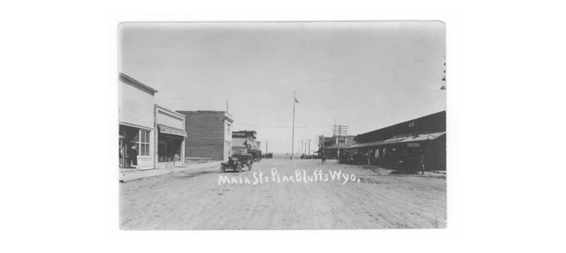
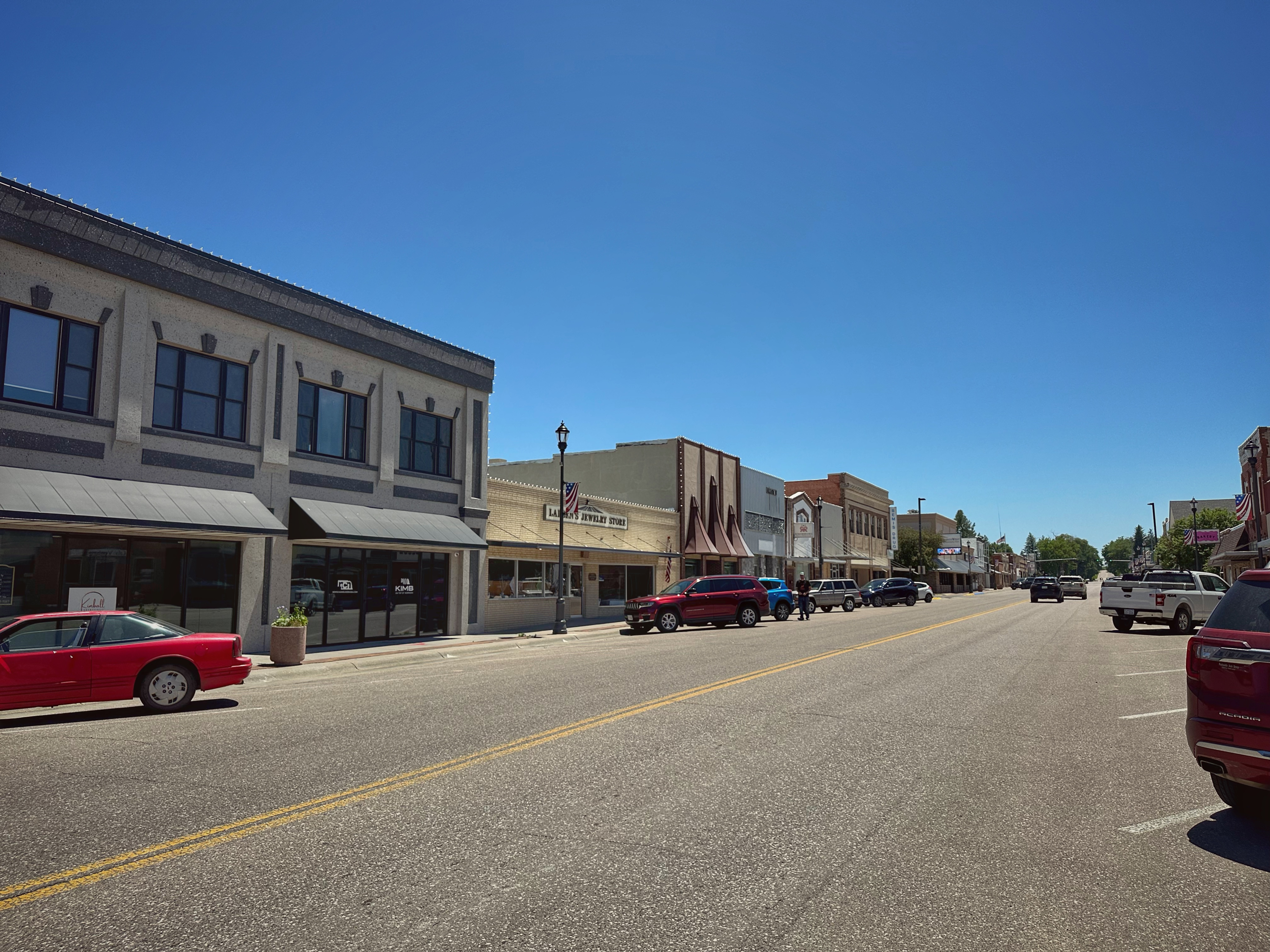


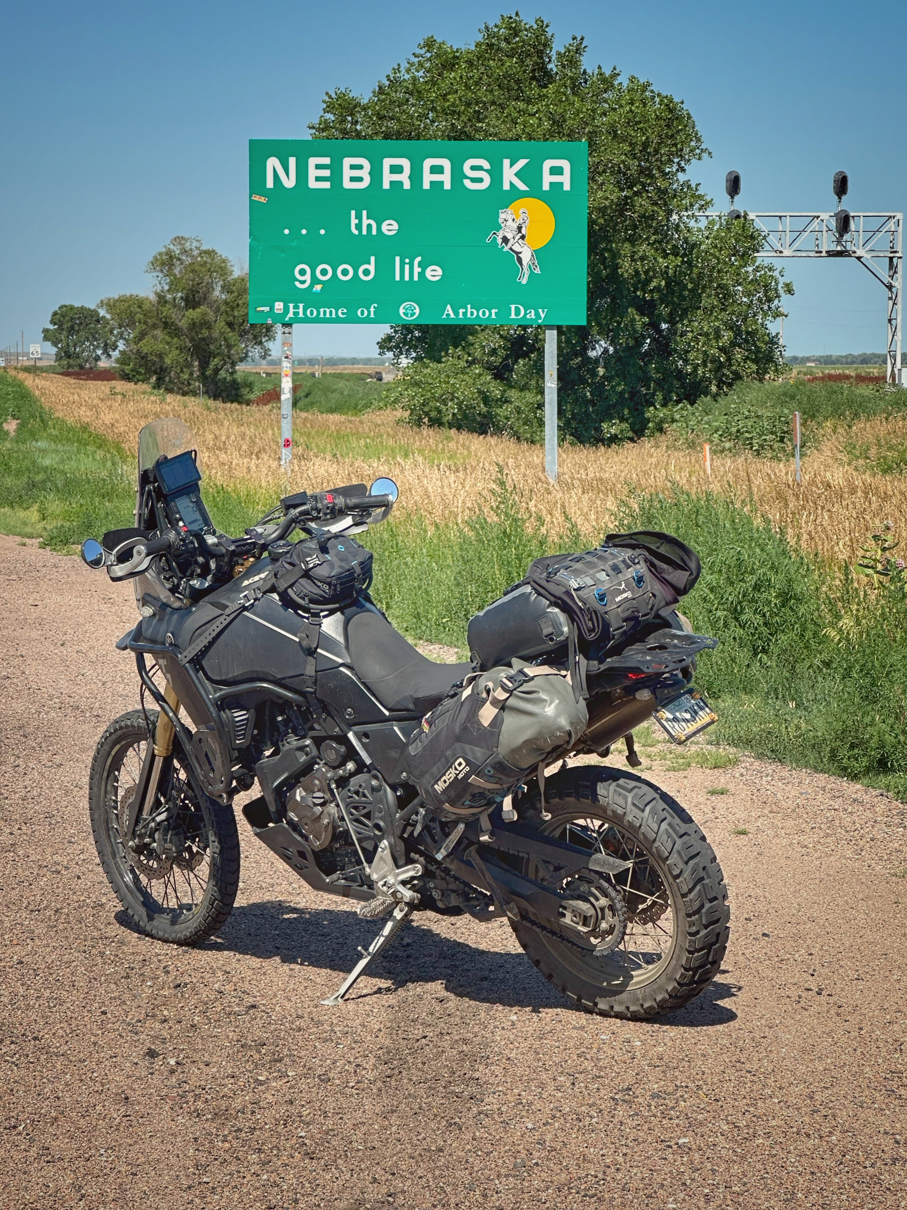
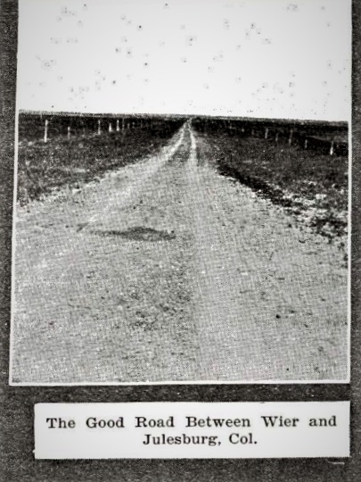

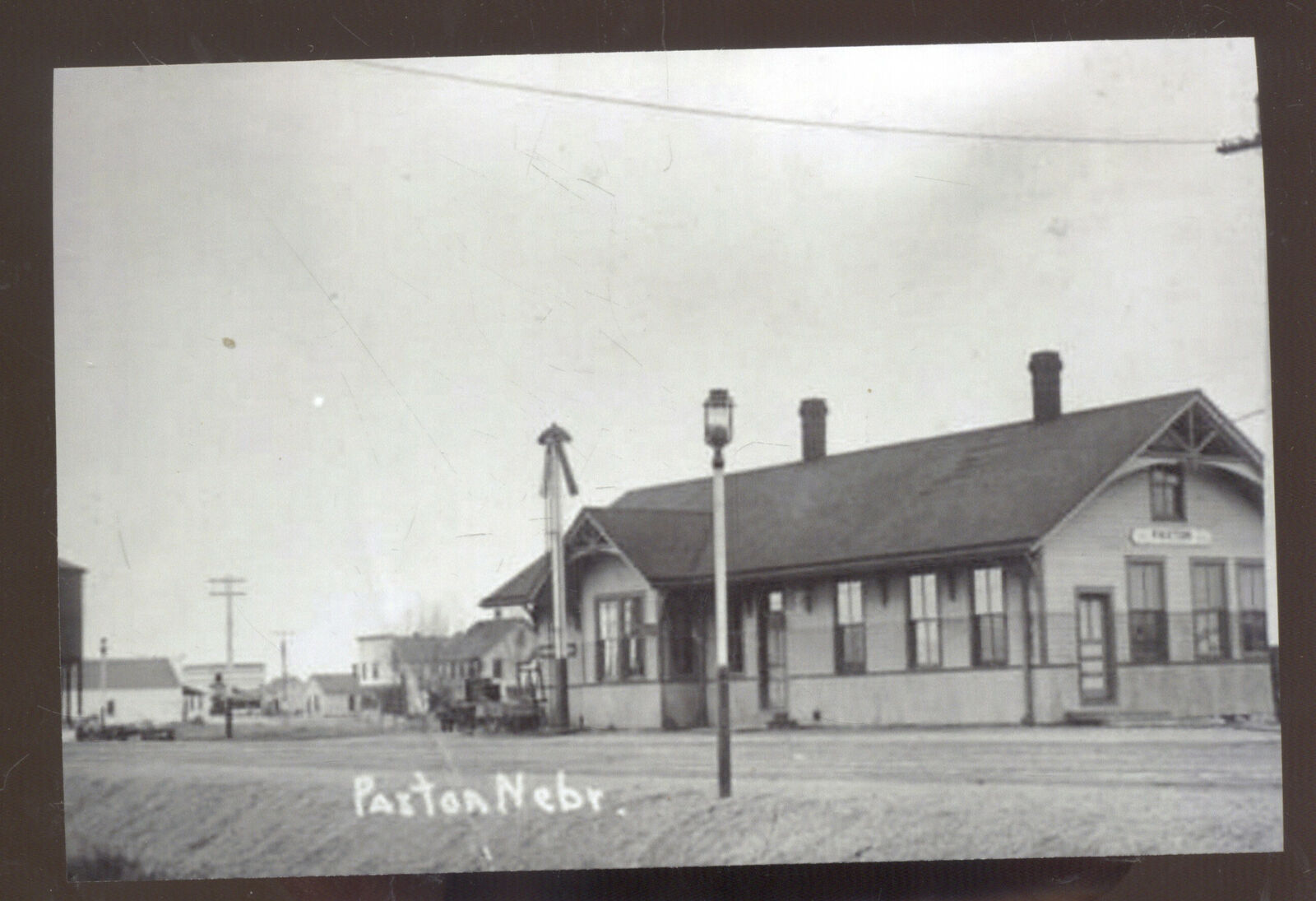


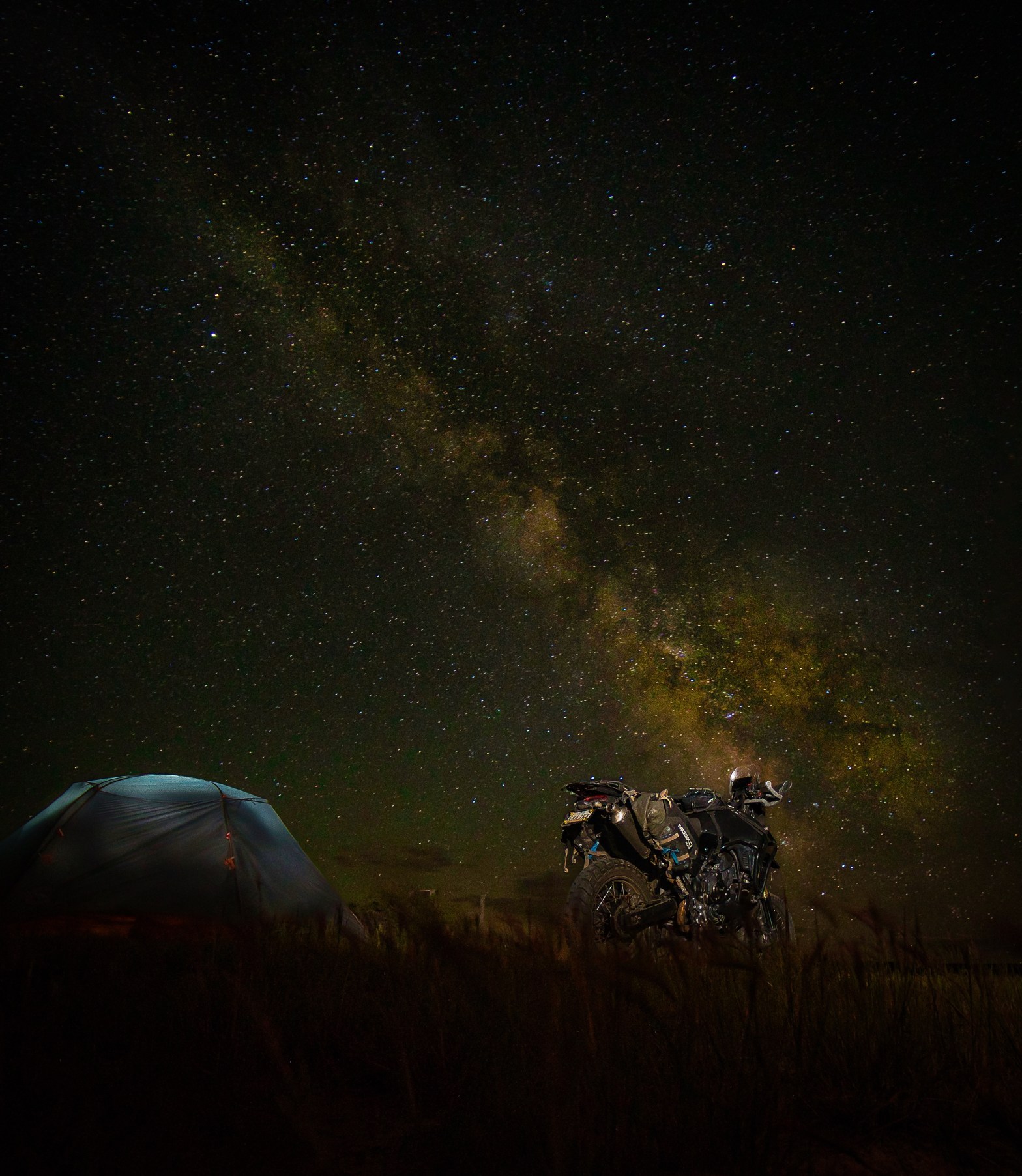


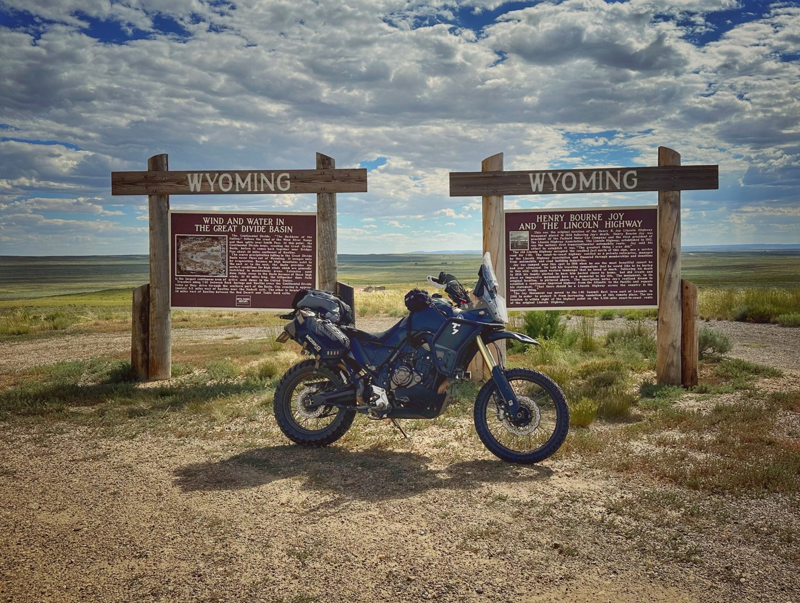

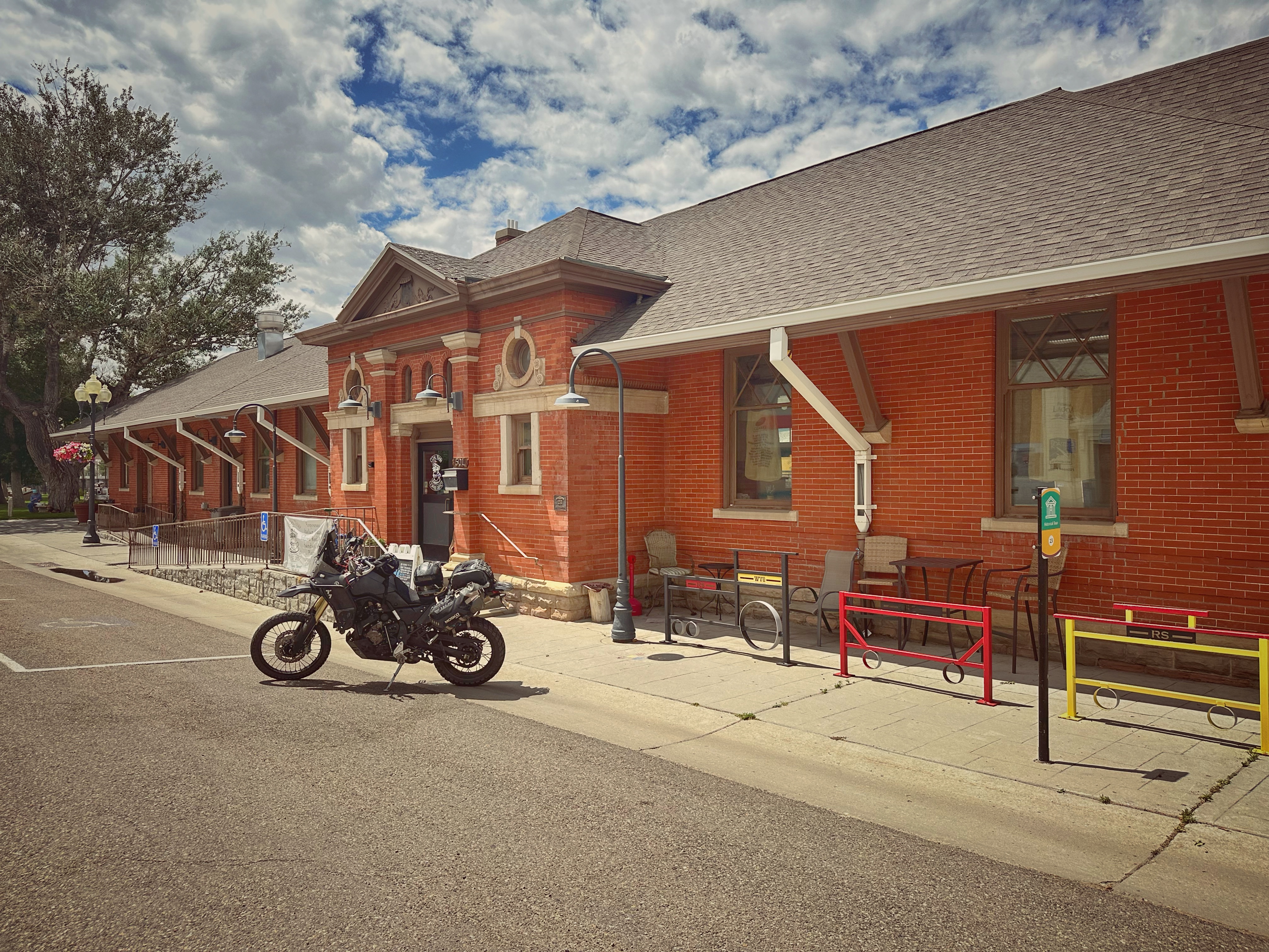
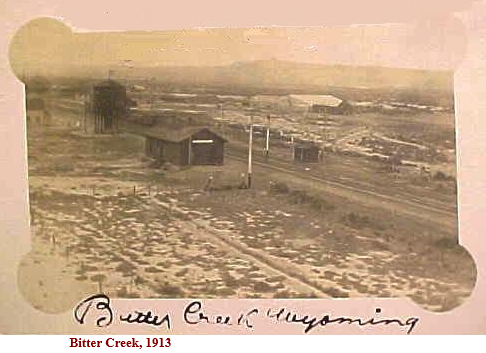


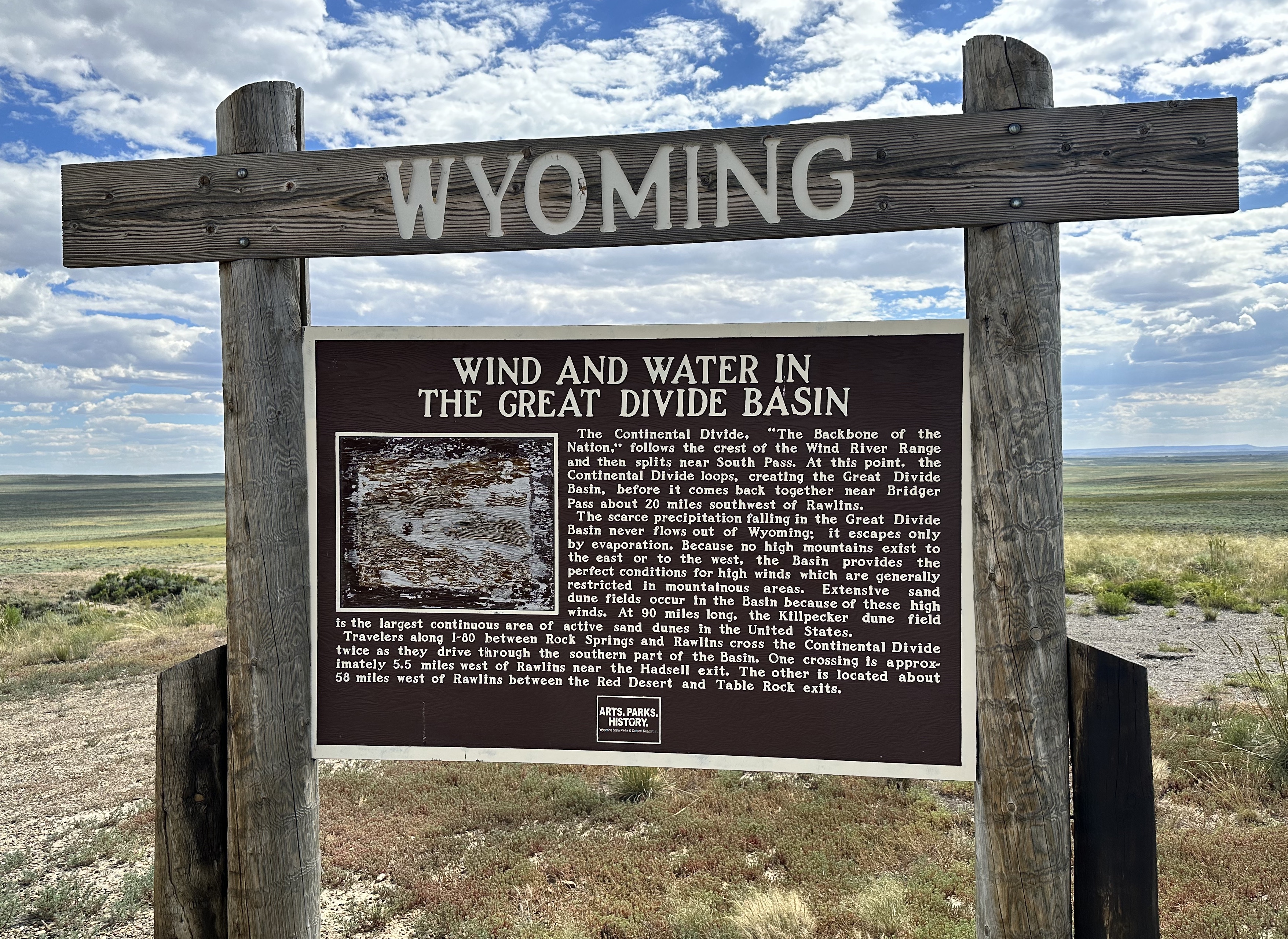
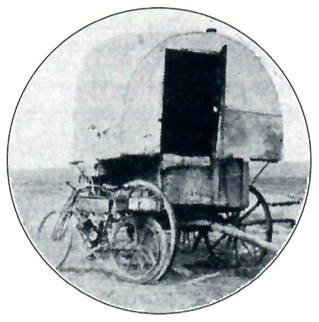


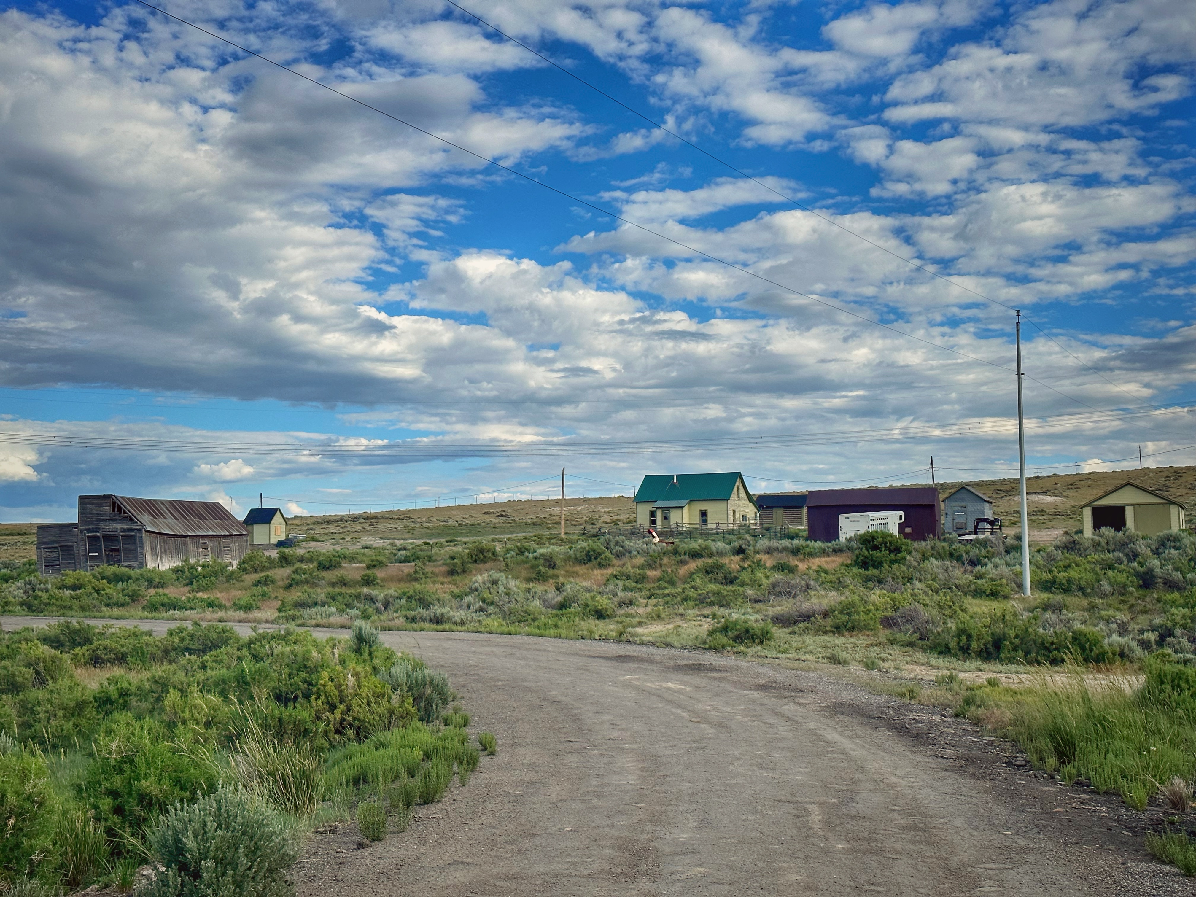

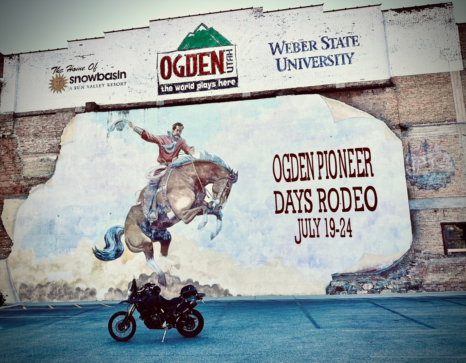
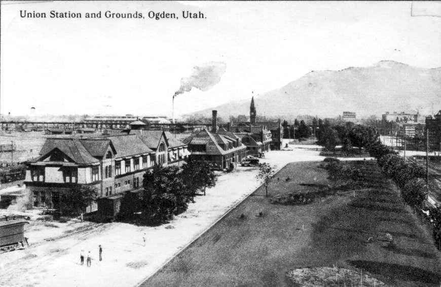
![[IMG]](https://photos.smugmug.com/Unlisted/USA-2019-S10/n-WmqJjv/USA-2019/i-dJ2KkTP/0/7f36c5bb/X2/barbers-156-X2.jpg)
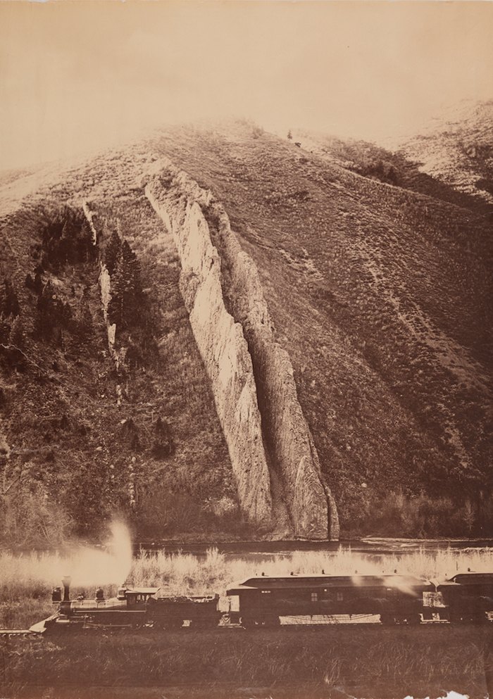
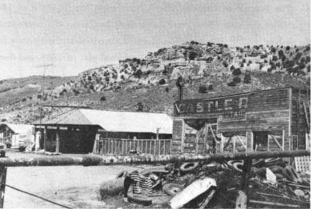
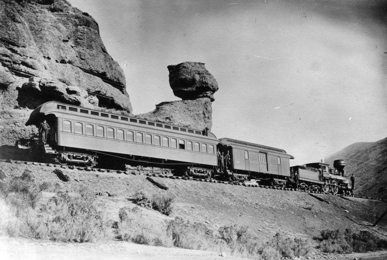

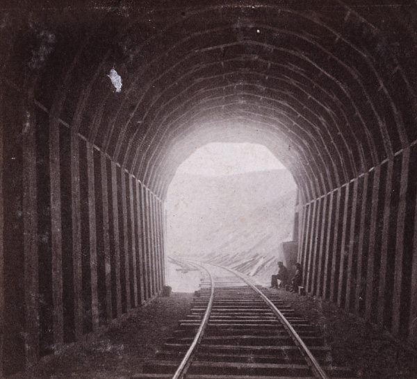
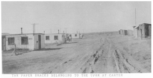

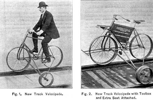

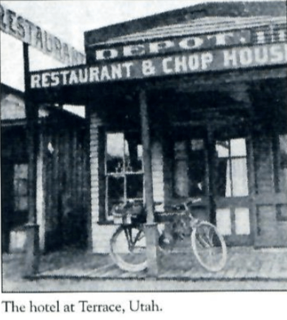


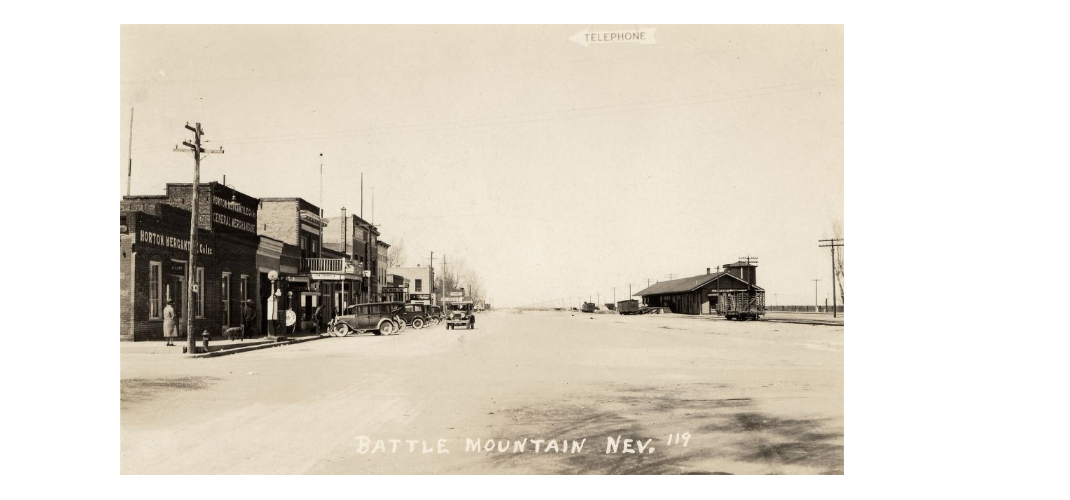
![[IMG]](https://photos.smugmug.com/Unlisted/To-AFGHANISTAN-then-onwards-RTW/n-CpTfZs/Phoenix-to-fish-and-chips/i-f7BG6xD/0/f98d4183/4K/IMG_5911-4K.jpg)
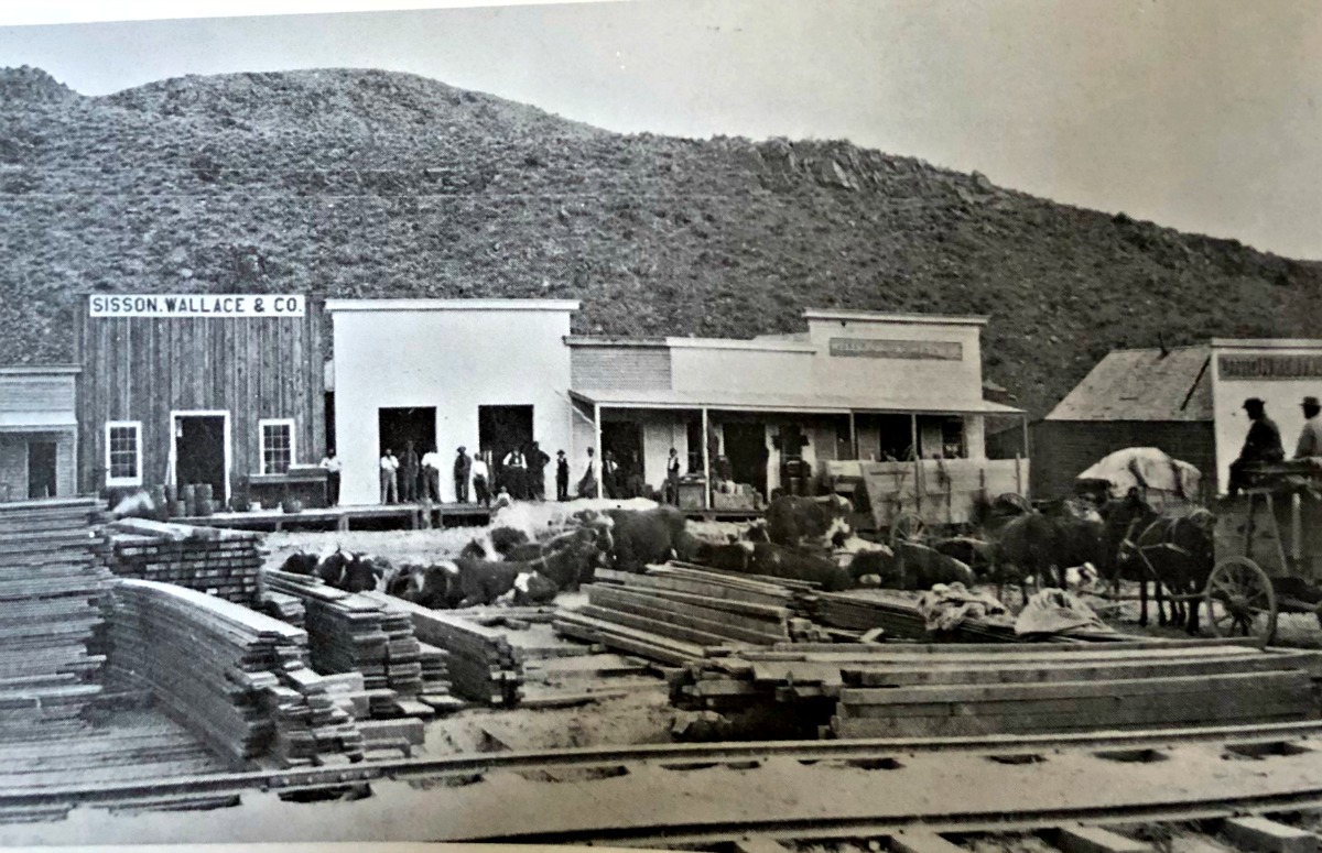


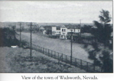
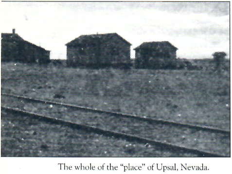
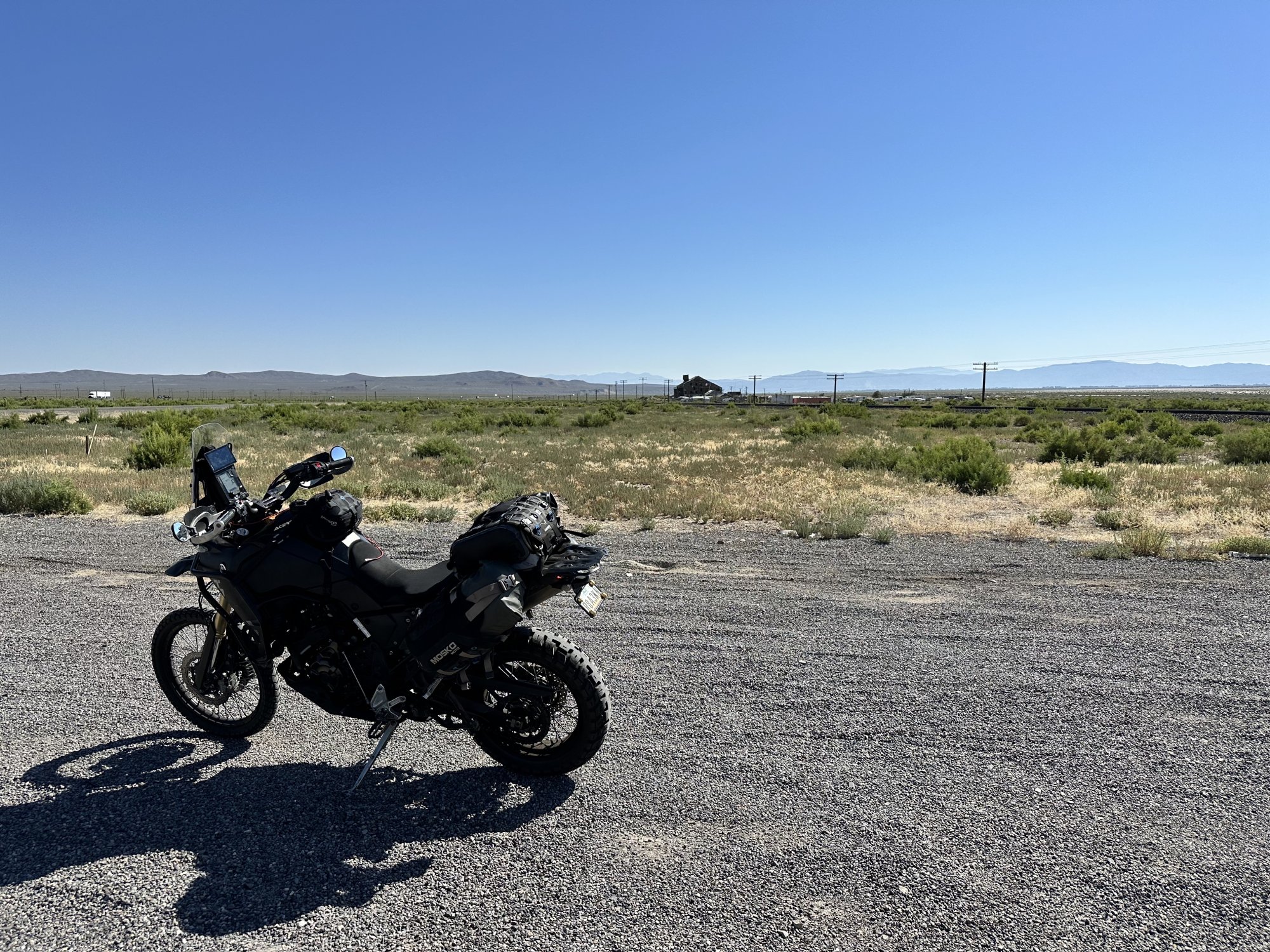

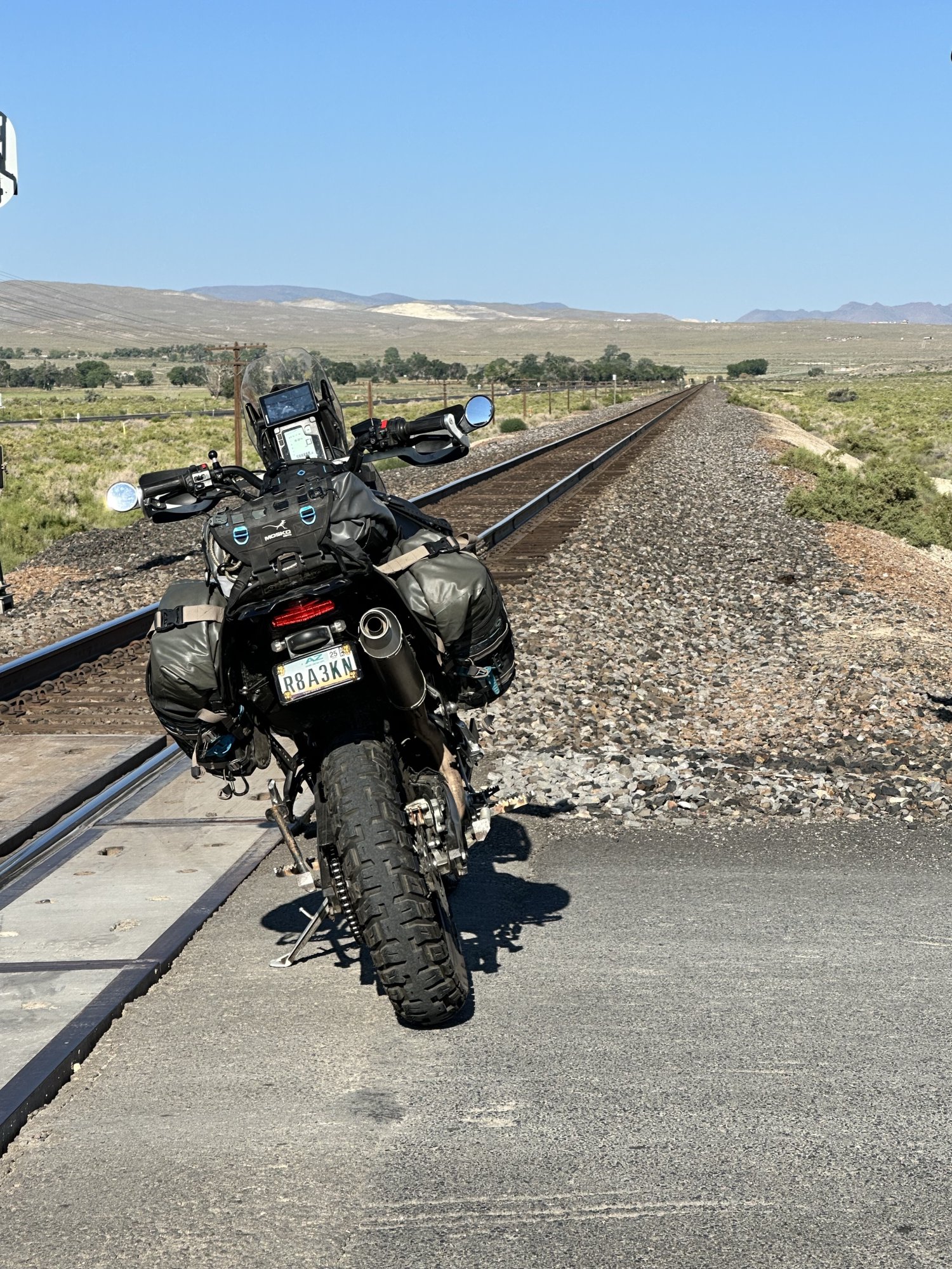
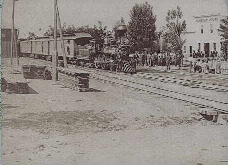


You must be logged in to post a comment.